Kosovo Physical Map. Gizimap.
Another map in Gizimap's excellent series of physical maps, this is the best physical map available for Kosovo.
$14.99
65-56906
1 sheet, folded
$19.99
65-56907
1 sheet, flat/rolled
$36.99
65-56907L
1 sheet, laminated
Ethnic Albania (Shqiperia Etnike). 1:550,000. Prof. Ahmet Ghasi. No date.
One sheet, in color, folded. The map is a shaded relief map with areas of forest overprinted. Also shows roads, railroads, "practicable roads", villages, commune centers, etc. With an index of a over 3000 or so names. The map has a 30' latitude/longitude grid. The map shows the borders of "Ethnic Albania" with a heavy hatchured line typical of international boundaries on most maps. It also shows the current borders of Albania as a "state boundary." The Ethnic Albania includes essentially all of Kosova, much of Macedonia, and parts of Greece and Montenegro.
$18.95
64-0745
1 sheet, folded
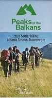
Peaks of the Balkans Trail Map. 1:60,000. Huber Verlag.
The transnational "Peaks of the Balkans Trail" guides through some of the most out of the way and wild mountain areas of the western Balkans. The "Peaks of the Balkans" walking map showing the trail through the mountains in the border region of Albania, Kosovo, Montenegro, and contains a detailed description of the various parts of the route including elevation profiles. Scale 1:60,000.
Sketch map of the hiking trail
 Sample detail of the Kosovo Travel Map
 Sketch map showing area covered by the Kosovo Map

 Sketch map of the hiking trail