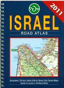
Israel Road Atlas. 1:150,000. Mapa, Israel, 2014.
Detailed road atlas in a handy 6 x 8 inch format. With city center maps for Jerusalem, Tel Aviv, Haifa, and Be'er Sheva. Also included is a guide to Israel's 100 best sites. With an extensive index of place names. 115 pages, spiral-bound. In English.
Sample detail from the Israel road atlas
$32.99
64-81891
Atlas
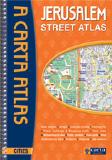
Recommended Jerusalem Street Atlas. 1:8,000 (city center) & 1:15,000 (all Jerusalem) & 1:2,800 (Old City). Carta, Israel.
Detailed street atlas, fully indexed, spiral-bound. Includes public buildings, shopping malls, archaeological sites, public gardens and vista spots, museums, hospitals, gas stations, one way streets, and much more. In English. 6½ x 9¼".
Sample detail from the Jerusalem street atlas
$29.99
64-8192JG
Atlas
Israel Road and Travel Maps
Recommended! Israel Road Map. 1:250,000. MAP, Tel Aviv.
Includes plans of the major cities. This is the most detailed travel map of Israel that is available. The map has all of the tourist and road information - the reverse side has the "100 Recommended Sites" listing, with contact info. The shaded relief features illustrates the topography.
Sample detail from the Israel road map
$24.95
64-81902
1 sheet, folded
Israel Road Map. 1:225,000. ITMB.
Israel is stable, it is prosperous, it is developing, and it is well-worth visiting. The Palestinian-controlled areas are sensitive, and Gaza is off-limits, but all sides appear to be trying hard not to provoke incidents that would be disruptive. Given the situation in Syria and to a lesser extent Lebanon and the risks faced by Jordan, Israel appears open, welcoming, and sensible. It has a well-developed infrastructure, including a marvelous car rental industry, tons of restaurants, historic sites everywhere, excellent accommodations, and a climate that would be the envy of most countries.
Sample detail from the Israel Road Map SAmple detail from the Israel Road Map Front of the Israel Road Map
$12.95
64-81904
1 sheet, folded.
Waterproof! Israel Travel Map. 1:275,000. National Geographic Maps.
The front side of the Israel map details the northern region of the country, from its border with Lebanon to the north, to Syria and Jordan to the east and the Mediterranean Sea to the west. The reverse side of the map details Israel's southern region; bordering Jordan to the east, Egypt and the Mediterranean Sea to the west, and the Gulf of Aqaba to the southernmost point. Map size is 26 x 38" unfolded.
Sample detail from the Israel travel map
$11.95
64-81909
1 sheet, folded.
Israel Physical Map. 1:270,000. Carta, Israel.
Detailed physical map of Israel. Elevation is shown using hypsometric contours with color-shading and spot heights. The main road network is shown, along with over 3,500 named locations, mountains, rivers, and streams. The Israel Walking Trail is marked, along with border crossings, ports and airports, and a detailed index.
$19.99
64-81476
1 sheet, folded.
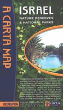
Israel Nature Reserves & National Parks Map. 1:270,000. Carta, Israel.
Road map of Israel highlighting the national parks and national preserves throughout the country.
Jerusalem - The Old City Map. 1:2,800. Carta, Israel. A double-sided map showing the Old City on one side and central Jerusalem on the reverse. Both maps have indexes to streets, buildings, and institutions. Sites and services marked include archaeological sites, ramparts walk around the Old City, Stations of the Cross (Via Dolorosa), Holy sites of the three faiths, lookout points, public restrooms, wall paintings, pictures on stone, private guesthouses, youth hostels, and much more. In English.
Sample detail from the Jerusalem Old City street map
$14.99
64-8192JO
1 sheet, folded.
In Hebrew Jerusalem Street Map. Israel Survey Dept. A detailed street map of Jerusalem, in Hebrew. It covers from Atarot in the north to Gilo and Khomat Shmu'el in the south.
Sample detail of the Jerusalem city map
$17.99
64-8192JF
1 sheet, folded.
Laminated Jerusalem Street Map. 1:8,000. Borch. Our laminated folded map of Jerusalem shows: Jerusalem 1:8,000, Bethlehem 1:11,000, Greater Jerusalem 1:30,000, Central Israel 1:400,000, Dome of the Rock, Holy Sepulchre, The Middle East administrative & time zones and Top 30 Sights. The map shows hotels, museums, monuments, markets, public transport, top sights and points of interest, useful statistics, conversion charts for temperatures, weights and measurements, climate charts showing temperatures, sunshine hours, precipitation and humidity, overview maps, time zones, and much more...
Sample detail of the Jerusalem laminated map Thumbnail of the front of the Jerusalem map Thumbnail of the reverse of the Jerusalem map
$9.95
64-8192JI
1 sheet, folded.
Waterproof Jerusalem City & Holy Land Map. 1:10,000 & 1:225,000. ITMB. This map shows Road by classification, Expressway, Major road, Secondary Road, Metro station, University, Point of interest, Post Office, Shopping Centre, Consulate, Sports Facility and much more...
Front of the Jerusalem map Reverse of the Jerusalem map
$10.95
64-8192JEH
1 sheet, folded.
Tel Aviv City Map. 1:13,500 & 1:10,000. Mapa, Israel. This is a good map of Tel Aviv, with clear cartography, a full index, with all names in Roman alphabet and the text in English. There is an inset map of the old city of Jaffa (Yafo) and descriptive text on the reverse. ISBN 965718438X
Sample detail of the Tel Aviv map
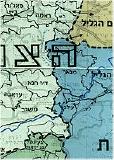
Map of Settlement in Eretz Israel. 1:250,000. Survey of Israel. This map shows the proliferation of settlements throughout Israel from up to 1997. The map differentiates settlements prior to 1977, settlements set up between 1977 and 1997, and settlements that have been approved but not yet set up. Data is overlain on the Israel Survey road map of Israel. The reverse side has descriptive text, lists of settlements with the year of foundation, etc. In English.
Sample of the map detail.
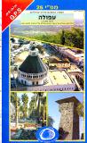
Israel 1:50,000 Topographic Quadrangle Map Set. 1:50,000. Israel Survey. This set offers complete coverage of Israel, the West Bank, the Gaza Strip. The maps are in Hebrew.
Click here to order and to see itemized listings, sample images, and index maps.
Israel Satellite Image & Panoramic Photograph Posters
Jerusalem Panoramic Poster. Spaceshots. This panoramic photograph of Jerusalem features the area of Jerusalem called the Old City with its four quarters, the Muslim, Jewish, Armenian and Christian Quarters. Surrounding the Old City is the Old City Walls. Centered in the photograph with its gold-domed roof is the Dome of the Rock.
Thumbnail of the entire poster


 Sample detail from the Israel road atlas
 Recommended
 Sample detail from the Jerusalem street atlas
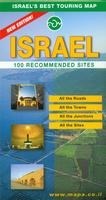 Recommended!
 Sample detail from the Israel road map
 Sample detail from the Israel Road Map
 SAmple detail from the Israel Road Map
 Front of the Israel Road Map
 Waterproof!
 Sample detail from the Israel travel map
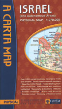

 Sample detail from the Jerusalem street map
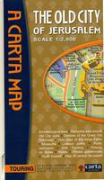
 Sample detail from the Jerusalem Old City street map
 In Hebrew
 Sample detail of the Jerusalem city map
 Laminated
 Sample detail of the Jerusalem laminated map
 Thumbnail of the front of the Jerusalem map
 Thumbnail of the reverse of the Jerusalem map
 Waterproof
 Front of the Jerusalem map
 Reverse of the Jerusalem map
 Sample detail of the Tel Aviv map
 Index map showing cities with available maps.
 Sample of the map detail
 Index showing sheet coverage
 Sample of the map detail.
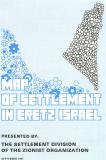
 Sample of the map detail.
 Index showing available sheets.
 Sample of the map detail.
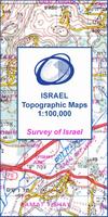
 Sample detail from the Israel 1:100,000 topographic map series.
 Index to the Israel 1:100,000 topographic map series.
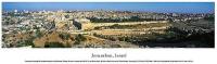
 Thumbnail of the entire poster