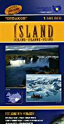
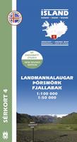
Landmannalaugar, Porsmörk, and Fjallabak hiking map. 1:100,000/1:50,000. Mal og Manning.
A quality hiking map that reaches from Hekla in the west to Lakagigar in the east. The map includes all hiking and driving routes of the area, along with place names and other useful information. On the reverse side you will find a map of Fimmvorduhals (1:50,000) with descriptions and photographs of the areas main attractions.
$24.95
64-7550-FJ
1 sheet, folded
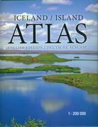
Iceland Road Atlases
Iceland Road Atlas. 1:200,000. Mal og Manning.
This atlas is designed for those who travel around Iceland, and want to get to know the country as well as possible. It comprises 78 new maps at 1:200,000, including 26,600 place names, which are listed in a detailed index. The map user sees the height of mountains, the depth of valleys, and the wide open spaces, in a spectacular bird's-eye view.
The atlas also includes 47 maps of the greater Reykjavk area and other towns, as well as useful information on swimming pools, campsites, museums and galleries, golf courses, bird-watching sites, and road distances. Descriptions and color photographs of 104 places of natural beauty and historic importance, along with drawings of birds, plants and seashells, will help to make your travels around Iceland unforgettable. Bilingual English/German. Spiral-bound.
Sample detail of a road map page from the Iceland road atlas. Sample detail of a city map page from the Iceland road atlas.
$64.99
64-75952
Atlas.
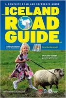
Iceland Road Atlas. www.Icelandroadatlas.com. This atlas covers Iceland's entire road system plus its geography, culture, and history. This is more of a guidebook with extensive detailed road maps rather than a traditional road atlas. The atlas covers all of the highland and mountain roads, showing detailed maps, extensive descriptive text, color photos, and numerous city maps. In English.
Sample of a text page. Sample of a text page. Sample of a map page. Image of the back cover.
$59.99
64-7587
Atlas.
Iceland Road Maps
Iceland Touring Map. 1:600,000. Mal og Manning, Iceland.
The map shows the most recent information on the country's road network, campsites, swimming pools, museums and road distances. The map uses shaded relief to show elevation. The reverse side has extensive tourist information and photographs of the country's main natural sites. Also shows is a comprehensive distance table. Multilingual.
Sample detail from the map.
The roads are classified into paved, unpaved, or gravel, and distances are shown between road junctions along major roads. The map shows elevation using color tinting and spot heights. Lots of place names for geographic features highlight glaciers, rivers, mountains, etc.
Tourist sites and services are noted with symbols. An inset map shows central Reykjavik in good detail.
Waterproof Iceland Adventure Travel Map. 1:465,000. National Geographic Maps.
The map includes the locations of cities and towns with a user-friendly index, plus a clearly marked road network complete with distances and designations for major highways, main roads, and tracks and trails for those seeking to explore more remote regions.
Recommended! Iceland Regional Touring Map Series. 1:300,000. Mal og Manning.
This 4-sheet set offers detailed coverage of all of Iceland. There is also a fifth sheet that covers the central Highlands of Iceland. The map uses color shading and contour lines to show elevation. The maps show the most recent information on the country's road network, campsites, swimming pools, museums and other useful tourist sites and services. The reverse has text and photographis of tourist sites in the area covered by that particular map sheet. Multilingual English/Icelandic/German/French. Each map is 86 x 110 cm.
Sample detail from the map.
$23.99
64-7553-1
Northeast Iceland.
$23.99
64-7553-2
Northwest Iceland.
$23.99
64-7553-3
Southeast Iceland.
$23.99
64-7553-4
Southwest Iceland.
$23.99
64-7553-5
Central Highlands.
Iceland 1:250,000 Topographic & Travel Maps. 1:250,000. Ferdakort.
Touring maps with contour lines and shading at 50 m intervals, based on new digital map data. The four maps in this category have considerable overlapping. They contain the latest information about Iceland's road system, including road distances and road numbers, as well as important tourist-service information. There are over 15,000 place-names on the maps, and a place-name index of all the maps is available in a separate booklet. These maps are specially folded for easy handling, making them particularly suitable when travelling.
Sample detail of the maps Sketch map showing coverage of each sheet.
$24.99
64-7552-T3
Northeast Iceland (Nordausturland).
$24.99
64-7552-T4
Southeast Iceland (Sudausturland).
$24.99
64-7552-T5
Highlands of Iceland (Halendid).
Reykjavik City Street Maps
Reykjavik Street Map. 1:15,000. Mal og Manning.
This map shows all of the streets of Reykjavik, the capital city of Iceland. The map also shows the optimum routes for tourist driving in and around the city. Multilingual.
Sample detail from the Reykjavik street map.
$23.99
64-7591RE
1 sheet, folded.
Iceland Hiking Maps
Golden Circle Road Map. 1:200,000. Ferdakort/IDNU.
A good quality map of the most popular tourist route in Iceland, Gullfoss - Geysir - Pingvellir. It has photos and information of the highlights of the tour such as the Blue lagoon. The map shows Iceland's road system, including road distances and road numbers, as well as important travel-service information.
Sketch map showing coverage of this map. Sample detail of the Golden Circle map Sample detail of the Golden Circle map
Gullfoss & Geysir hiking map. Sheet 2. 1:100,000/1:50,000. Covers the huge Gullfoss waterfall and the original "Geysir", which with 64-7550-RE Pingvellir are the three most popular tourist sites in Iceland.
$23.99
64-7550-F
Hornstrandir hiking map hiking map. Sheet 9. 1:100,000/1:50,000. Covers the huge Gullfoss waterfall and the original "Geysir", which with 64-7550-RE Pingvellir are the three most popular tourist sites in Iceland.
Pingvellir-Reykjanes hiking map. Sheet 1. 1:100,000/1:50,000. This map covers Pingvellir,Parliament Meadow, and the Rift Valley. This is the most popular tourist site in Iceland.
Westman Islands (Vestmannaeyjar) hiking map. 1:50,000. Ferdakort/IDNU.
A map with an overview of the Westman Islands, plus an inset map of the main town. This title is a topographic map of the islands, with a street plan of the built-up area on Heimaey. On the reverse, an aerial photo shows Haimaey Island at 1:10,000. The map has a grid showing latitude and longitude in steps of 1' and 2' respectively. Map legend is in Icelandic only.
Sample detail of the Golden Circle map
$19.99
64-75515-8
Iceland Hiking Guide
Walking and Trekking in Iceland Guide. This Paddy Dillon guide to walking and trekking in Iceland offers routes throughout the country, including the classic Laugavegur Trail from Landmannalaugar to Porsmörk. Routes range from easy walks and challenging treks. Lots of tips for budget travellers and on public transport, accommodation and other facilities.
$29.95
64-75951WA
Guide.
Iceland Topographic Quadrangle Maps
Note: Iceland topographic maps are no longer available as original paper maps. We have limited inventory left.
Iceland 1:50,000 Topographic Quadrangle Maps. 1:50,000. Landmaelingar Islands (Iceland Geodetic Survey), 1977-1990. Only partial coverage is available, shown by the dark orange quads on the index map. Maps processed from aerial photographs showing the land surface in considerable detail, with 20-metre contour lines, roads, tracks, place names, etc. Printed with 1 km. grid squares for easier positioning. Sheet size: 73.5 x 57 cm .
We stock select sheets for certain popular tourist spots such as Hekla, and Myvatn. Otherwise these are special-order items with a 3 week delivery time.
NOTE: Four sheets make up each numbered block; see block 2316 for the numbering scheme. Numbers go NE = 2316-1; SE = 2316-2; NW = 2316-3; SW = 2316-4
Sample image Index map
$17.95
64-7549
Each, specify sheet number at checkout
Iceland Topographic Quadrangle Maps. 1:100,000. Revision dates 1937-1989. Landmaelingar Islands (Iceland Geodetic Survey). This set of 87 sheets offers complete coverage of Iceland. The complete set is also available in hardbound atlas format with removable pages. Bilingual. We have listed a few sheets covering the most popular tourist areas.
1:100,000 index. Sample #1 Sample #2
$17.95
64-7550
Each, rolled
Iceland Geologic and Thematic Maps
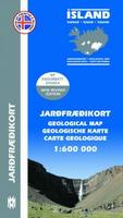
Iceland Geologic Map. 1:600,000 Mal og Manning, 2009.
This map presents the geology of Iceland as a bedrock geology map, overlaying a topographic base map. The map emphasizes the main geologic features of Iceland. Formations are classified by age, type and composition. The map shows the volcanic rock units, with the lava units divided into prehistoric and historic lava. Multilingual.
Sample detail from the Iceland geologic map.
$23.99
64-7500
1 sheet, folded.
Iceland Tectonic Map. 1:600,000. Mal og Manning, 2009.
The map highlights structure of the country, overlain on a topographic base map. This map is a bit unusual in that it classifies the rock by age, but not by rock type. The map shows the volcanic rocks, the main volcanic fissures and volcanoes. Multilingual.
Sample detail from themap.
$23.99
64-7520
1 sheet, folded.
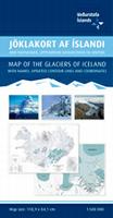
Iceland Glaciers Map. Ferdakort.
Overview map of Iceland's glaciers, including named and unnamed ice masses. The map shows changes in glacier extent since the Little Ice Age maximum, around 1890, to the beginning of the twenty-first century. Also shown is the extent of glaciers around the middle of the twentieth century. The main subglacial volcanoes are illustrated on the map. Note that surge-type glaciers are denoted in a separate colour. Information with map in Icelandic, English, French and German.
$26.99
64-7532
1 sheet, folded.
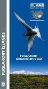
Iceland Birdwatcher's Map. (Fuglakort Islands). Mal og menning, 2003. This map has three inset maps showing the main birdwatching areas, the staging areas for migratory birds, and the important wildlife watching areas. The main part of this double-sided "map" are numerous 4½ x 4½" sections, each covering a single specie of bird. Each section has a small map showing the range of the bird, a drawing of the bird in typical plumage, a drawing of an egg, and symbols showing whether the bird is a migratory bird, a regular breeder, protected specie, winter visitor bird, resident bird, land or water birds, etc. Text is in four languages including English.


 Sample detail of a road map page from the Iceland road atlas.
 Sample detail of a city map page from the Iceland road atlas.
 Sample of a text page.
 Sample of a text page.
 Sample of a map page.
 Image of the back cover.
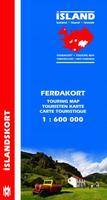
 Sample detail from the map.
 Waterproof!
 Sample detail from the Iceland travel map.
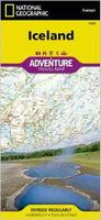 Waterproof
 Sample detail of the Iceland Adventure Map
 Image of the front of the Iceland Adventure Map
 Image of the back of the Iceland Adventure Map
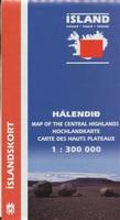 Recommended!
 Sample detail from the map.
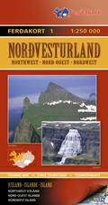
 Sample detail of the maps
 Sketch map showing coverage of each sheet.
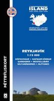
 Sample detail from the Reykjavik street map.
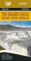
 Sketch map showing coverage of this map.
 Sample detail of the Golden Circle map
 Sample detail from the Kjolur map.
 Sketch map showing the sheet layout.
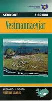
 Sample detail of the Golden Circle map
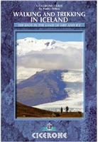
 Sample image
 Index map
 1:100,000 index.
 Sample #1
 Sample #2
 Sample detail from the Iceland geologic map.
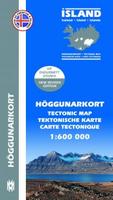
 Sample detail from themap.