|
|
Hungary Hiking Maps. Various scales. These maps (with contour lines) cover a wide variety of excellent hiking/biking areas in Hungary. Most of these maps are in Hungarian only.
(Hungary) Cycling and Watersport Atlas of the Tisza River (Kerékpáros és Vizitúra Térkép Tisza). 1:100,000. Cartographia. German & Hungarian. Map covers the Tisza river from Szeged to Tokaj. Two volumes.
Tisza River Watersports map. 1:35,000. Paulus, 2002. Very detailed canoe and riversport map of the Tisza River between Tiszabecs to Szeded. Maps show recommended routes and tourist services and sites. In Hungarian.
Hungary Travel and City Maps
Hungary Road & City Atlases
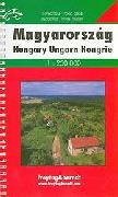
Hungary Supertouring Atlas. 1:250,000. Freytag & Berndt, 2005. Detailed spiral-bound road atlas. Complete with city maps, postal codees, and full index. Multilingual legend.
Historical Hungary Road Atlas (Magyarország Autótépe) on CD-ROM. Hungarian Road Atlas circa 1930. Full color road Atlas of Hungary originally printed in the 1930's. Contains 90 full color pages of maps and town plans. Extremely detailed.
Hungary Road & City Atlas (Magyarország autós Atlasza és Városatlasza). Z-Press Kiado. This is another of the many Hungarian road atlases. We like this one because the atlas includes city maps for 134 cities in Hungary. The road maps are at 1:360,000; the city maps vary in scale. The index includes all the streets on all the maps. These are spiral-bound atlases, measuring 10 x 13.5 inches. In Hungarian.
Hungary Tourist Guide & Map (Magyarország a túratervezö útikalauz). 1:450,000. This is a detailed tourist guide with extensive information on hotels, restaurants, and sites to see. Complete with a 1:450,000 road map. Bilingual English/Hungarian. Ideal for a traveller spending time in Hungary.
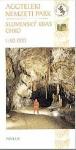
Hungary Tourist Atlas, Budapest-Hollohazaig (Az Orszagos Kektura Budapest-Huvosvolgytol Hollohazaig). 1:40,000. Cartographia Budapest. 2001. Spiral bound atlas covers hiking trails through mountainous, northern Hungary. 160 pages. ISBN 963 352 536 5. Hungarian/German.
Hungary Road & City Maps
Hungary Atlas for Anglers. 1:300,000. Topopress, Budapest. Good shaded relief map with 1235 fishing sites located and with basic information listed in the index. 160 pages, spiral-bound. In Hungarian.
Hungary Telephone Area Codes Map. 1:500,000. In Hungarian.
Lands of the Holy Hungarian Crown 1914 (Länder der Heiligen ungarischen Krone - A Magyar Szent Korona országai 1914). 1:820,000. Szarvas, Budapest, no date. Includes coats-of-arms for each district. In Hungarian. ISBN 963-9251-44-5.
Hungary Postal Codes Map (Magyarország Postai Irányítószámos Térképe). 1:500,000. Stiefel. No date. One sheet, in color, with 35-page index booklet. In Hungarian.
Hungary Postal Code Map (Magyarország Postai Irányítószámai). 1:560,000. Szarvas/Dimap, Budapest, no date. Shows all 2-digit zones plus four-digit codes within those zones. Fully indexed on the reverse. ISBN 963-9251-70-4.
(Hungary) Carpathia Road Map. 1:250,000. Dimap, Budapest. This map covers the Carpathia region of the junction of Hungary, Slovakia, Ukraine, and Romania. The map is a topographic map with tourism and road information added.
(Hungary) Carpathian Basin Relief Map. 1:1,000,000. TopGraf, Budapest, 2000. This is a shaded relief map that covers the entire Carpathian Basin, including parts of Hungary, Slovakia, Romania, the former Yugoslavia, etc. Multilingual.
(Hungary/Romania) Land of Székelys (Székelyföld/Tara Secuilor/Szeklerland). 1:250,000. The legend and the names of the inhabited places are given in Romanian, German and Hungarian, indexed (including the historical names), short description of the history in Hungarian.
. Hungary Topographic Quadrangle MapsHungary 1:10,000 Topographic Maps. 1;10,000. There is about 65% coverage - please see index map for extent of current coverage. In Hungarian.
Hungary 1:25,000 Topographic Quadrangle Maps. Cartographic Institute of the Hungarian Defence Forces. There are 1066 sheets for total coverage. Hungary was the first communist country to release their topographic maps to the public. They are also the highest quality maps of any of the eastern block countries. The Hungarians use their own grid system rather than longitude and latitude on their maps.
Recommended
Hungary 1:100,000 Topographic Quadrangle Maps. 1:100,000. In Hungarian.
Hungary 1:200,000 Topographic Quadrangle Maps. 1:200,000. In Hungarian.
. Hungary Physical and Political MapsHungary Physical Map. 1:500,000. Cartographia. This one-sheet map has contour lines and shaded relief. It is accompanied by a 41-page gazeteer. 112 x 75 cm. In Hungarian.
Administrative Map of Hungary. 1:450,000. Szarvas. With postal codes, administrative boundaries, etc. Fully indexed. In Hungarian.
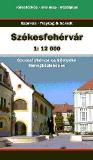
Hungary County Atlases. This series of twenty county atlases contains city street maps at 1:10,000 to 1:20,000 for all settlements in the given county. Bigger settlements also have a street index. In Hungarian. Each settlement has some descriptive text. Excellent detail for the various regions of Hungary. We have listed a few of these before. These atlases are in the process of being reissued in new editions. In Hungarian.
Hungary Geologic and Thematic MapsHungary Geologic Map. 1:1,000,000. 1984. Cartographia. 110 x 76 cm. In Hungarian.
Hungary Hydrogeological Forecast Map of Hungary (Magyarország Vizföldtani Prognózis Térképe). 1:500,000. 1989. GI. One sheet in color, showing rock type and groundwater potential. In Hungarian.
Hungary Geomorphic Map (Magyarország Geomorfológiai Térképe). 1:500,000. Cartographia. In Hungarian.
|
||||||||||||||||||||||||||||||||||||||||||||||||||||||||||||||||||||||||||||||||||||||||||||||||||||||||||||||||||||||||||||||||||||||||||||||||||||||||||||||||||||||||||||||||||||||||||||||||||||||||||||||||||||||||||||||||||||||||||||||||||||||||||||||||||||||||||||||||||||||||||||||||||||||||||||||||||||||||||||||||||||||||||||||||||||||||||||||||||||||||||||||||||||||||||||||||||||||||||||||||||||||||||||||||||||||||||||||||||||||||||||||||||||||||||||||||||||||||||||||||||||||||||||||||||||||||||||||||||||||||||||||||||||||||||||||||||||||||||
 Hungary Maps & Guides


 Sample #1
 Sample #2
 Sample of the bilingual text.
 Sample of the map.
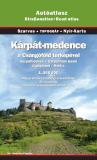
 Sample #1 of a road map page
 Sample #2 of road map page
 Sample of a city map
 Sample from the Cluj city map


 Sample detail of the Hungary road map
 Image of the front of the Hungary road map
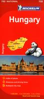
 Sample #1 of the Hungary road map
 Sample #2 of the Hungary road map


 Sample of the map detail
 Sample of Budapest sheet at 1:10,000
 Hungary 1:25,000 - Eastern Hungary
 Hungary 1:25,000 - Western Hungary
 Sample of the map detail
 Detailed index - 2Mg image file.
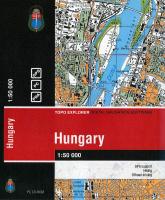 Hungary 1:50,000 Topographic Map Digital Set. 1:50,000. DigiTerra. Compatible with most GPS software, PC, and Pocket PC. This CD-ROM set includes complete coverage of Hungary using the 316 military topographic maps noted above, at 150 dpi resolution. Includes search options for place, hydrographic, region, and relief names.
 Screen shot #1
 Screen shot #2
 Screen shot #3
 Hungary 1:200,000 and 1:100:000 (71K)
  Hungary 1:25,000 and 1:50:000 (109K)


 Hungary Flags