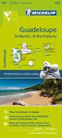
New map Guadeloupe, St. Martin, and St. Barthelemy Travel Map. 1:80,000. Michelin.
This map for this French-speaking Caribbean island includes an index, distance chart, and legend in English for easy reference. Travelers adventuring on their own will appreciate Michelin's high standard of clear, accurate mapping of the main, secondary and back roads as they navigate around Martinique. The information on scenic drives and sites, recreational activities, points of interest and walking paths will add to the enjoyment of the visit. ZOOM map #137.
$12.95
66-33784
1 sheet, folded.
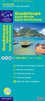
Guadeloupe, Saint-Martin, Saint-Barth&eacout;lemy Tourist Map. 1:100,000. France IGN, 2010, 3rd edition. This edition lacks contour lines but has spot heights. Numerous symbols locate tourist sites and services. Inset maps of Pointe-à-Pitre and Basse-Terre are satellite image base maps with streets overlain. Size is 47 x 37 inches, folded, in French with English/French legend.
Sample detail from the Guadeloupe travel map.
$18.99
66-33783
1 sheet, folded.
Guadeloupe and Martinique Travel Map. 1:65,000 & 1:100,000. ITMB, 2011. This is really two maps sharing one piece of paper. Each map fills one side and is a separate title in its own right. Martinique might be somewhat smaller in area, but is arguably better developed for tourism. In any case, this Caribbean island is lovingly portrayed and includes tourist resorts, nature reserves, beaches, dive sites, gas stations, marinas, camp sites, and anything else we could think to add. A beautiful inset map of the capital, Ile de France, is included. Guadaloupe, and its adjacent islands, fills the other side, along with a detailed inset of Point-a-Pitre, its capital. In addition to all the attractions shown on the Martinique side, this map shows the ferries to the 'out' islands of Marie-Galante, Les Saintes, and La Desirade. For extra value, we have added inset maps of Sint Martin and of Saint-Bartholomey at 1:100,000, which will at least provide map coverage for these islands until we can get around to preparing more detailed maps. This is the first new mapping of this part of the Caribbean in a decade or more, and is MUCH more economically priced than the 'other' maps. As an adjuct, these islands are linked to each other and to Saint Lucia and Dominica by inter-island ferries. This new system of ferries is linking the islands together for tourism, as well as economic cohesion.
Sample detail of the Martinique travel map
$12.95
66-33814
1 sheet, folded.
Guadeloupe Topographic Quadrangle Maps. 1:25,000. IGN. Five sheets give complete coverage. In French.
$16.95
66-3378B
Sheet 4601, Morne a l'Eau, Grande Terre.
$16.95
66-3378C
Sheet 4602, Lamentin, Basse Terre.
$16.95
66-3378D
Sheet 4603, Point a Pitre, Grande Terre.
$16.95
66-3378E
Sheet 4604, St.-François, La Desirade.
$16.95
66-3378F
Sheet 4605, la Soufriere, Les Saintes.
$76.25
66-3378
Set of 5 sheets, folded
FFRP D971 Guadeloupe Hiking Guide. FFRP. This guide, in French, describes nearly 50 hikes from 1 to 6 hours. The guide includes extracts from the 1:25,000 topographic maps showing the various trails.
$21.99
FFRP-D971
Guide
Geologic Map of Guadeloupe. Includes two maps; Geologic Map of Grande Terre (Carte Géologique de Département de la Guadeloupe Grande Terre) and Geologic Map of Marie-Galante(Carte Géologique de Département de la Guadeloupe Marie-Galante; 1993). 1:50,000. BRGM, Paris. For Grande Terre, the map legend and 47-page text are in French. For Marie-Galante, the map covers this island just off the coast of Guadeloupe. Legend and 76-page text in French.
$68.95
66-3375
1 sheet + text.
Guadeloupe 1:25,000 GPS Digital Maps.
Guadeloupe, St. Maartin, and St. Barthelemey CartoExplorer 1:25,000 Digital Topographic Maps. France IGN.
1:25,000 topographic maps
Points of interest are marked
Points of interest include additional information; telephone numbers, hours of operation, etc.
Calculate itinerary
Automatically survey your last route with an elevation profile


 New map

 Sample detail from the Guadeloupe travel map.

 Sample detail of the Martinique travel map


 Index map showing coverage.
 Sample from the France set, Puy de Sancy 3D view.
 Sample from the France set, Briançon 3D view.
 Sample from the France set, Lac Pavin 3D showing points of interest tags.
 Sample from the France set, Points of interest for Nice.