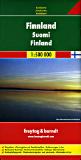
Finland Recreation, Travel and City Maps & Atlases.
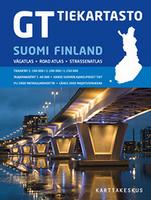
Road Atlas of Finland (Suomi Vägatlas). 1:200,000 & 1:400,000. WSOY (Genimap). The 13th edition of the GT Roadatlas Finland
includes accurate information of the roads and streets covering the whole country. The southern part of Finland is in scale 1:200,000 and the northern part (Lapland) in scale 1:250,000. You can find many points of interest, for example: National parks, hotels, Bed & Breakfast, petrol stations and public baths. If
you travel in Archipelago of Turku you can find all the connections and timetables for ferries. The table of distances helps you a lot to plan your trip. The atlas covers also the city center maps of the 40 biggest cities in Finland. The city maps are in scale 1:40,000. The most popular points of interest are also included
such as: Naantali, Punkaharju, Ruka and Saariselkä. You can find also over 50,000 place names, which are naturally indexed to the map. All the legends are in Finnish, Swedish, English and German. The atlas is easy to handle because of the spiral binding. Also the parallel names are used in Swedish and Lappish.
Sample of the detail of the atlas.
$67.99
64-55891
Atlas
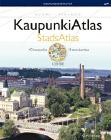
Finland City Atlas (Kaupunki Atlas Suomi). 1:20,000. Karttakeskus, 2006. This atlas contains 1:20,000 city street maps for 40 Finnish cities, including Helsinki ympäristöineen, Forssa, Hamina, Heinola, Hyvinkää, Hämeenlinna, Iisalmi, Imatra, Joensuu, Jyväskylä ympäristöineen, Kajaani, Kemi, Kokkola, Kotka, Kouvola ympäristöineen, Kuopio, Lahti ympäristöineen, Lappeenranta, Lohja, Mikkeli, Oulu ympäristöineen, Pieksämäki, Pietarsaari, Pori, Porvoo, Raahe, Rauma, Rovaniemi ympäristöineen, Salo, Savonlinna, Seinäjoki ympäristöineen, Tampere ympäristöineen, Tornio, Turku ympäristöineen, Vaasa ympäristöineen, Valkeakoski, Varkaus. There is a 1:30,000 regional map of Helsinki. Spiral-bound, in Finnish.
Sample #1 Sample #2
$79.95
64-55896
Atlas.
(Finland) Helsinki Atlas (Helsinki-Atlas). 1:60,000. Kaupunkimittausosasto. 1986. This is a thematic map atlas of Helsinki with the maps generally at 1:60,000 scale. The maps include general maps, topographic maps, environmental maps, laand use maps, statistical maps, education & culture maps, and technical (infrastructure) maps. In a 3-ring binder with removeable map pages. In Finnish/Swedish.
$50.00
64-5571
Atlas
Finland Travel Map. 1:750,000. ITMB.
The southern half of the country is on one side, along with two large inset maps of Helsinki and region. The network of roads and lakes on this side is fascinating. The other side concentrates on the northern portions, with a certain amount of overlap into Sweden and Norway. Border information with Russia is also noted
Front of the Finland travel map. Reverse of the Finland travel map.
Waterproof! Finland and Northern Scandinavia Adventure Map. 1:975,000. National Geographic Maps.
National Geographic's Finland and Northern Scandinavia AdventureMap is designed to meet the unique needs of adventure travelers-detailed, durable, and accurate. Scandinavia North includes the locations of thousands of cities and towns with an index for easily locating them, plus a clearly marked road network complete with distances and designations for expressways, motorways, and more. ISBN 9781566955324.
Sample detail of the Finland adventure map Image of the front of the Finland adventure map Image of the back of the Finland adventure map
$11.95
64-55906
1 sheet, folded
Finland Motoring Road Map. 1:800,000. FLSD.
The Motorist's road map of Finland has its 80th anniversary in 2007! This is the most popular road map of Finland. The map, at 1:800,000, is a perfect scale and size for use in a car; not too big, but with enough detail to not leave you stranded on a back road somewhere. There are 12 different road types shown, including paved and unpaved roads. A nice touch is that the color of the road numbers on the map match the color of the actual road signs. The distances are marked in the map in a distance table.
An index of the place names has been added to the map. Multilingual legend, including English.
$20.99
64-55895
Each, folded
Finland Travel Map. 1:750,000. ITMB.
The southern half of the country is on one side, along with two large inset maps of Helsinki and region. The network of roads and lakes on this side is fascinating. The other side concentrates on the northern portions, with a certain amount of overlap into Sweden and Norway. Border information with Russia is also noted
Front of the Finland travel map. Reverse of the Finland travel map.
$12.95
64-55907
1 sheet, folded.
Finland Travel Map. 1:500,000. Freytag & Berndt. Larger and more detailed than the official Finland road map listed above, this double-sided map offers excellent road detail, with 8 levels of road classification, distances between road junctions, shaded relief and spot heights for elevation, and railroads, ferries, etc. Multilingual, including English. With separate index booklet.
Sample image.
Finland Road/Topographic Maps. 1:200,000 - 1:250,000. Karrtakeskus, 2005-2007. Recently reformatted, this series switched from 18 sheets at 1:200,000 to 17 sheets at 1:250,000 plus one sheet at 1:100,000 centered on Helsinki. There are only two sheets left to convert to the new format (noted below), although all 17 sheets were updated in 2005, 2006, or 2007. This series is designed as very detailed road maps with contour lines. These maps also show all of the highways, byways, dirt roads, and snowmobile trails. The contours are at 20m, with additional spot heights and shaded relief. Various administrative boundaries are shown, including restricted areas, national park and preserve boundaries, etc. Both UTM and latitude/longitude grids are shown on the map. Each sheet measures approximately 100 x 82 cm. Bilingual.
Finland 1:200,000/1:250,000 Road/Topo Map Index Sample image.
$33.99
64-5552-01
Sheet 1. Avhenanmaa - Turku. 1:250,000. 2007.
$33.99
64-5552-02
Sheet 2. Helsinki - Lahti. 1:250,000. 2007.
$33.99
64-5552-03
Sheet 3. Lahti - Kotka - Lappeenranta. 1:250,000. 2006.
Finland City Street Maps. Genimap/Karttakeskus. Most are in Finnish; a few are bilingual.
$19.95
64-5592AH
Ahtari. 1:6,000/1:40,000. 1989.
$19.95
64-5592AN
Anjalankoski. 1:10,000. 1996.
$19.95
64-5592ES
Espoo. 1:20,000. 1996.
$19.95
64-5592ET
Etalä-Karjala. 1:15,000. 1992.
$19.95
64-5592HA
Hamina. 1:15,000. 1997.
$19.95
64-5592HB
Hanko. 1:10,000. 1998.
$21.99
64-5592HC
Heinola. 1:15,000. 1997.
$19.99
64-5592HE
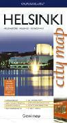
Helsinki. 1:20,000.
$99.95
64-5592HF
Helsinki. Axonometric (bird's-eye view) map of central Helsinki.
$19.95
64-5592HY
Hyvinnkaa. 1:15,000. 1997.
$19.95
64-5592HM
Hameenlinna. 1:20,000. 1997.
$19.95
64-5592II
Iisalmi. 1:15,000. 1993.
$19.95
64-5592IM
Imatra. 1:20,000. 1998.
$21.99
64-5592JA
Jarvenpaa (Tuusulassa). 1:15,000. 1994.
$19.95
64-5592JO
Joensuu. 1:15,000. 1994.
$19.95
64-5592JY
Jyvaskyla. 1:20,000. 1996.
$19.95
64-5592KA
Karjaa. 1:10,000. 1993.
$19.95
64-5592KE
Kemi. 1:15,000. 1997.
$19.95
64-5592KF
Kerava loppu (Tuusulassa). 1:15,000. 1997.
$19.95
64-5592KI
Kirkkonummi. 1:30,000. 1997.
$19.95
64-5592KO
Kokkola. 1:15,000. 1997.
$19.95
64-5592KP
Kotka. 1:15,000. 1998.
$19.95
64-5592KU
Kuopio. 1:20,000. 1995.
$19.95
64-5592LB
Lahti. 1:15,000. 1997.
$19.95
64-5592LC
Lappeenranta. 1:15,000. 1996.
$19.95
64-5592LO
Lohja. 1;15,000/1:35,000. 1997.
$19.95
64-5592LP
Loviisa. 1:15,000. 1989.
$19.95
64-5592MA
Mantsala. 1:10,000. 1992.
$19.95
64-5592MI
Mikkeli. 1:15,000. 1997.
$19.95
64-5592NI
Nivala. 1:10,000. 1991.
$19.95
64-5592NO
Nokia. 1:15,000. 1993.
$19.95
64-5592NU
Nurmijarvi. 1:20,000. 1992.
$19.95
64-5592OU
Oulu. 1:15,000. 1997.
$19.95
64-5592PJ
Pietarsaari. 1:15,000. 1996.
$19.95
64-5592PO
Pohj.Kl/Kouvola. 1:20,000. 1995.
$19.95
64-5592PP
Pori. 1:15,000. 1995.
$19.95
64-5592PQ
Porvoo. 1:10,000. 1991.
$19.95
64-5592RA
Raahe. 1:15,000. 1996.
$19.95
64-5592RC
Rauma. 1:15,000. 1995.
$19.95
64-5592RI
Riihimaki. 1:10,000. 1997.
$24.99
64-5592RO
Rovaniemen seutu. 1:15,000. 1997.
$19.95
64-5592SA
Salo. 1:10,000. 1997.
$19.95
64-5592SB
Savonlinna. 1:15,000. 1997.
$19.95
64-5592SE
Seinajoki. 1:10,000. 1994.
$19.95
64-5592SI
Sipoo. 1:20,000. 1995.
$19.95
64-5592SU
Suonenjoki. 1:15,000. 1987.
$19.95
64-5592TA
Tammisaari. 1:10,000. 1996.
$19.95
64-5592TB
Tampere + Pirkkala. 1:20,000. 1996.
$19.95
64-5592TU
Turku. 1:20,000. 1994.
$21.99
64-5592TV
Turunseutu. 1:20,000. 1997.
$19.95
64-5592TW
Tuusula. 1:20,000. 1997.
$19.95
64-5592UU
Uusikaupunki. 1:25,000. 1995.
$19.95
64-5592VA
Vaasa + Mustasaari. 1:15,000. 1997.
$19.95
64-5592VB
Valkeakoski. 1:10,000. 1997.
$19.95
64-5592VD
Vantaa suora. 1:20,000. 1997.
$19.95
64-5592VE
Varkaus + haja-as.alue. 1:15,000. 1997.
$19.95
64-5592VI
Vihti. 1:25,000. 1997.
$19.95
64-5592YL
Ylojarvi. 1:25,000.
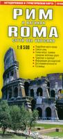
Helsinki City Map, in Russian. 1:15,000 & 1:8,000. These are for those that want cyrillic-language maps of European capital cities - for Russian-speaking patrons/customers, for Russian-language classes, etc. All are standard folded tourist city street maps, with index. All of the maps are in cyrillic and in the local language. Additional cities available include Helsinki, London, Paris, Prague, Rome, Stockholm, Vienna - please see the appropriate country listing to order these maps.
Sample detail of the Rome city map
Finland Scenic Regions Map (Maisemalueet ja maisema-maakunnat). 1:1,600,000. Kartta. 1992. Shows scenic region boundaries. In Finnish/Swedish.
$11.95
64-5569
1 sheet, folded
Finland Topographic Maps and Physical and Political Maps
Finland Terrestrial Relief Map. 1:1,000,000. FLSD. In Finnish.
$29.95
64-5549
Each, rolled
Finland 1:20,000 Topographic Quadrangle Maps. FLSD. Each set offers complete coverage of Finland. In Finnish or Finnish/English. To order, in the "comments" section of the checkout form, list the name of the area or town needed and we will confirm with you before shipping. We hope to have an index map on-line shortly.
$33.99
64-55492
1:20,000. Per sheet.
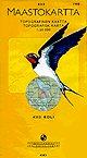
1:50,000 topographic maps. FLSD. To order, check the index map and list the sheet number in the "comments" section of the order check-out form. If you cannot tell the sheet you need, list the area or town name in the "Comments" section and we will confirm the sheets with you.
Index map. Sample of the map detail
$26.95
64-55495
1:50,000. Per sheet.
Geological and Thematic Maps
Finland Pre-Quaternary Geologic Map. 1:1,000,000. 1980. FGS. Shows pre-Quaternary rocks. 73 x 120 cm. Bilingual Finnish/English.
$29.95
64-5500
1 sheet, rolled
Finland Quaternary Deposits Quadrangle Maps. 1:400,000. FGS. Coverage of most of the country is available. The maps of Northern Finland were published in 1906-1953. The maps of southern Finland were published in 1963-1986. Bilingual. These are special-order sheets.
$19.95
64-5531
Each, specify area
Finland Map of Gravel and Sand Deposits. 1:1,000,000. FGS. In Finnish.
$29.95
64-5560
1 sheet, rolled
Finland Land Ownership Map. 1:1,000,000. FLSD. In Finnish.
$29.95
64-5566
1 sheet, rolled
Finland Population Density Map (Väentiheys Suomi). 1:1,000,000. 1985. FGS. Bilingual.
 Sample of the detail of the atlas.
 Sample #1
 Sample #2
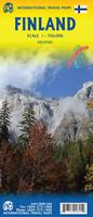
 Front of the Finland travel map.
 Reverse of the Finland travel map.
 Front of the Finland and Sweden travel map.
 Reverse of the Finland and Sweden travel map.
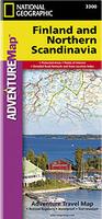 Waterproof!
 Sample detail of the Finland adventure map
 Image of the front of the Finland adventure map
 Image of the back of the Finland adventure map

 Sample image.
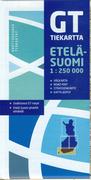
 Finland 1:250,000 Road Map Index
 Sample detail of the Finland road map series.
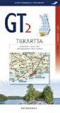
 Finland 1:200,000/1:250,000 Road/Topo Map Index
 Sample image.
 Sample detail of the Rome city map
 Northern Finland index
 Southern Finland index
 Map showing locations of Finland national parks.

 Index map.
 Sample of the map detail