El Salvador Digital 1:50,000 Topographic Maps for Memory Map software. 1:50,000. Omnimap, GoTrekkers, and MemoryMap. Includes complete 1:50,000 topographic coverage for El Salvador. These digital maps are made from the US military 1:50,000 topographc maps of El Salvador (map dates are 1969-1999). The set includes a full version of Memory-Map Discoverer, a $75 value. Maps can be set up to print along roads or your trails. Print up to 13" x 19" on paper. Can be used as secondary navigation for boating or flying with a go-to VOR-style arrow to your next waypoint. Allows you to upload/download routes, tracks & waypoints to & from most gps, laptops & pda's on Windows operating systems. Note that the maps themselves will not download onto a gps. Export your map as a bitmap image. Software in English/French/Spanish/German, base topographic maps are in English.
64-5252MM
Set.
$69.99
Travel and City Maps
El Salvador Travel Map. 1:375,000. ITMB. This is a hypsometric travel map with tourist information, an index, and an inset map of San Salvador. The map shows towns, villages, provincial boundaries, roads and railways. The overview map of San Salvador is included, naming the most important streets in the city and showing major buildings. A latitude/longitude grid at 10' interval is shown on the map.
Sample #1 Sample #2
64-5290
1 sheet, folded
$11.95
Waterproof!
Nicaragua, Honduras, El Salvador Travel Map. Scale 1:710,000. National Geographic Maps. The front side of the Nicaragua/Honduras/El Salvador map includes Honduras and El Salvador, two countries whose coastlines offer wonderful opportunities to surf, scuba dive, snorkel, or just soak up the sun. Sites for these activities and more are noted, as are hotels, lodges, and resorts. Nicaragua covers the back side of the map, and its detail includes diverse points of interest from museums and historical sites in Managua and Granada to areas noted for windsurfing, fishing, and observing the country's unique wildlife. Size is 26 x 38".
Sample detail of the Nicaragua travel map Front of the Nicaragua travel map Rear of the Nicaragua travel map
El Salvador Tourist Map. 1:400,000 & 1:18,000. El Salvador IGCN. A folded tourist map with a road map on one side and a San Salvador city map on the reverse. The road map is an unattractive tourist map that lacks details, but has with travel information in the margins. The reverse side has a decent street map of San Salvador. Size is 22 x 34". In Spanish.
64-52902
1 sheet, folded.
$9.95
San Salvador City Maps. El Salvador IGCN.
64-5292SQ
San Salvador.Paper. 1:6,400. 59 x 90", flat. A huge, beautiful wall map, high quality color-plot on a single paper sheet. All streets are indexed.
$119.95
64-5292SQL
San Salvador.Laminated. 1:6,400. 59 x 90", flat. A huge, beautiful wall map, high quality color-plot on a single paper sheet; laminated. All streets are indexed.
$159.95
64-5292SS
San Salvador. 1:15,000. 2005, 4th edition. 36 x 53", flat.
$34.95
San Salvador City Topographic Map. 1:15,000. NGA/NIMA. Four sheets now give complete coverage of San Salvador. The maps have city streets, contour lines, and much more. These are not tourist maps, rather they are detailed topographic maps covering the city.
64-5292SR
4 sheets, folded.
$89.99
El Salvador City Maps. El Salvador Instituto Geografico y del Catastro Nacional (IGCN). These full-color maps have street-level detail, latitude/longitude ticks along the margins, either UTM or latitude/longitude grid, no contour lines. There are two series of maps; the "old" series from the 1980-1990's and the "new" series from the 2000's. There is no overlap between the two series. A few of the old series are available only as good quality color copies of original maps (supplied to us by the IGCN). In Spanish.
64-5292AC
Acajutla. 1:5,000. 1990. Old series.
$12.95
64-5292AH
Ahuachapan. 1:5,000. 1982. Old series - color copy of original map.
$12.95
64-5292AY
Ayutuxtepeque. 1:5,000. 2006. 34 x 46", flat. New series.
$19.95
64-5292AN
Antiguo Cuscutlan. 1:5,000. 2006. 30 x 40", flat. New series.
$19.95
64-5292AP
Apopa. 1:8,000. 2006. 36 x 46", flat. New series.
$19.95
64-5292CO
Cojutepeque. 1:5,000. 1988. Old series.
$12.95
64-5292CU
Cuscatancingo. 1:5,000. 2006. 30 x 42", flat. New series.
$19.95
64-5292DE
Delgado. 1:5,000. 2006. 36 x 47", flat. New series.
$19.95
64-5292IL
Ilopango. 1:8,000. 2006. 36 x 49", flat. New series.
$19.95
64-5292LU
La Union. 1:5,000. 1990. Old series.
$12.95
64-5292ME
Mejicanos. 1:8,000. 2006. 40 x 26", flat. New series.
$19.95
64-5292NE
Nejapa. 1:7,000. 2006. 25 x 36", flat. New series.
$19.95
64-5292SA
Santa Ana. 1:10,500. 2003. 28 x 34", flat. New series.
$19.95
64-5292SM
San Marcos. 1:5,000. 36 x 47", flat. New series.
$19.95
64-5292SMI
San Miguel. 1:7,500. 1988. Old series - color copy of original map.
$12.95
64-5292SN
San Martín. 1:7,000. 2003. 30 x 39", flat. New series.
$19.95
64-5292SO
Sonsonate. 1:5,000. 1985. Old series - color copy of original map.
$12.95
64-5292SP
Soyopango. 1:8,000. 2006. 36 x 39", flat. New series.
$19.95
64-5292ST
Santa Teclay. 1:8,000. 2006, 3rd ed. 28 c 39", flat. With contour lines and street index.
$19.95
64-5292SV
San Vicente. 1:5,000. 1990. Old series.
$12.95
64-5292TO
Tonocatepeque. 1:7,000. 2003. 36 x 38", flat. New series.
$19.95
64-5292US
Usulutan. 1:5,000. 1990. Old series.
$12.95
64-5292ZA
Zacatecoluca. 1:5,000. 1991. Old series.
$12.95
Topographic Maps
El Salvador 1:100,000 Topographic Quadrangle Maps. IGM/DMA. There are six sheets for total coverage. Unfortunately only two sheets are still in print and available in color; four sheets are black/white copies of the original sheets. In Spanish.
64-5252-01
Sheet 1. Santa Ana. 1974. Color original.
$14.95
64-5252-02
Sheet 2. Chalatenango. 1976. Black/white copy.
$14.95
64-5252-03
Sheet 3. Jocoaitique. 1976. Black/white copy.
$14.95
64-5252-04
Sheet 4. San Miguel. 1978. Black/white copy.
$14.95
64-5252-05
Sheet 5. San Salvador. 1976. Black/white copy.
$14.95
64-5252-06
Sheet 6. Sonsonate. 1974. Color original.
$14.95
64-5252
Set of 6 sheets, rolled.
$54.95
El Salvador 1:50,000 Topographic Quadrangle Maps. 1:50,000. IGM. 1969-continuing. The 55 sheets give complete coverage of El Salvador. In Spanish.
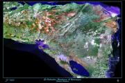
El Salvador, Honduras, Nicaragua Satellite Image Poster. SatPrint. A beautiful satellite poster print/map encompassing the Central American countries of El Salvador, Honduras, and Nicaragua. This image is a Landsat TM (thematic mapper) image. Size is 24 x 36".
65-0886L
Laminated.
$49.95
El Salvador Political and Physical Maps
El Salvador General/Political Maps (Mapa Oficial República de El Salvador). IGN. The following maps all show provincial borders, roads, towns and villages, etc. All are political maps overprinted on a physical base map. The larger the scale, the more detail. In Spanish.
Recommended! Mapa Oficial de la Republica de El Salvador. 1:120,000. El Salvador IGCN, 2003. A huge political map with shaded relief as a background layer. Includes a list of all departments and municipalities. Lambert projection. 59 x 90 inches! In Spanish.
64-52495
1 sheet, rolled.
$74.95
El Salvador Political/Physical Map (Mapa Oficial de la Republica de El Salvador). 1:200,000. 2003, 5th ed. A political map with a shaded relief physical map as the background. Includes a list of all of the departments and the municipalities. Size is 36 x 54", flat. In Spanish.
64-5249
1 sheet, flat.
$29.95
El Salvador Political/Physical Map (Mapa Oficial de la Republica de El Salvador). 1:300,000. A political map with a shaded relief physical map as the background; a reduced-size version of 64-5249 above. In Spanish.
64-52485
General Map. 1:300,000.
$14.95
El Salvador Small-scale Maps. El Salvador IGCN. Small-sized maps ideal for desk-tops for binders. In Spanish.
64-5247
General Map. 1:1,000,000.
$3.95
64-5248
General Map. 1:500,000.
$9.95
El Salvador Department Maps. 1:100,000. El Salvador IGCN. These full-color maps have contour lines with 50 meter intervals, latitude/longitude ticks along the margins, road network, towns and villages and much more. All maps are at 1:100,000 so the sheet size varies to fit the size of the department. Flat/rolled. In Spanish.
64-5245-AH
Ahuachapán. 2006. 23 x 30".
$19.95
64-5245-CA
Cabañas. 2006. 22 x 27".
$19.95
64-5245-CH
Chalatenango. 2006. 32 x 38".
$19.95
64-5245-CU
Cuscatlan. 2006. 26 x 20".
$19.95
64-5245-LL
La Libertad. 2006. 34 x 32".
$19.95
64-5245-LP
La Paz. 2006. 23 x 27".
$19.95
64-5245-LU
La Unión. 2006. 39 x 28".
$19.95
64-5245-MO
Morazán. 2006. 29 x 26".
$19.95
64-5245-SA
Santa Ana. 2006. 35 x 32".
$19.95
64-5245-SM
San Miguel. 2006. 38 x 34".
$19.95
64-5245-SS
San Salvador. 2006. 31 x 24".
$19.95
64-5245-SO
Sonsonate. 2005. 27 x 20".
$19.95
64-5245-SV
San Vicente. 2006. 29 x 28".
$19.95
64-5245-US
Usulután. 2005. 32 x 35".
$19.95
Geological and Thematic Maps
El Salvador Geologic Map (Mapa Geológico de la República de El Salvador/America Central). 1:100,000. 1978. BGR (Germany). Six sheets depict the geology of this Central American country. Sheet size approx. 96 x 83 cm. In German and Spanish.
64-5200
6 sheets, rolled
$74.95
El Salvador Geologic Map (Mapa Geológico de la República de El Salvador). 1:500,000. IGN/BGR. 1974. Shows generalized geology. In Spanish/German.
64-5201
1 sheet, rolled
$12.95
El Salvador Gravimetric Map (Carta Gravimetrica 1984-1985: Anomalías Bouguer Simple). 1:300,000. El Salvador ICGN, 1986. One sheet, in color. In Spanish.
64-5210
1 sheet, rolled
$12.95
El Salvador Magnetic Map (Carta Magnetométrica Lecturas de Intensidad Total). 1:300,000. El Salvador ICGN, 1981. One sheet, in color. In Spanish.
Note: Now out of print; we have one copy left.
64-5212
1 sheet, rolled
$15.95
Rio Lempa Hydrologic Map (Mapa Hidrologico del Rio Lempa). 1:300,000. El Salvador IGCN, 1976. In Spanish.
64-5231-02
1 sheet, flat.
$12.95
Nautical and Aeronautical Charts
El Salvador Aeronautical Chart (Carta Aeronautica Republica de El Salvador). 1:500,000. El Salvador IGCN, 1978. A physical map with hypsometric shading, flight information (flight paths, radar stations, etc.), and latitude/longitude grid. Size is 18 x 33". In Spanish.
64-5260
1 sheet, flat.
$15.95
El Salvador Nautical Charts. 1:500,000. El Salvador IGCN. In Spanish.
64-5265-CH005
Bahia de Ilopango (Ilopango Bay). 1:20,000. 1984. With inset map of the main port. Depth in meters.
$19.95
64-5265-CH007
Puerto de Acajutla (regional chart). 1:20,000. 1984. Approaches to and the coastline on boths of Acajutla. Depth in meters.
$19.95
64-5265-CH003
Puerto de Acajutlia (harbor chart). 1:10,000. 1971. Detailed chart of the harbor. Depth in fathoms.
$19.95
64-5265-CH100
Rio Paz al Puerto de la Libertad (the Paz River and Port of La Libertad - regional chart). 1:100,000. 1989. With inset map at 1:25,000. Depth in meters.
$19.95
64-5265-CH002
Puerto de la Libertad (Port of La Libertad - harbor chart). 1:10,000. 1969. Detailed chart of the harbor. Depth in fathoms.
$19.95
64-5265-LL1
Lago de Ilopango (Lake Ilopango). 1:20,000. 1981. With four inset charts of the main dock areas on the lake.
$19.95
64-5265-LL2
Lago de Coatepeque (1:10,000 & 1:20,000); Lago de Llano (1:5,000); Lago de Chanmico (1:5,000). Four lake charts on a single sheet.

 and Cerro Verde (center). Photo by Ukiedukie, via Wikipedia.")


 Sample #1
 Waterproof!
 Sample detail of the Nicaragua travel map

 Image of the El Salvador road map