NOTE: These Reise digital maps require one of the four software programs to view the maps. They are not viewable without one of the software programs. A couple of these companies have a free viewer, and all have high quality viewing/navigating/manipulating programs that once installed will work with any Reise digital map and also allows uploading of scanned maps in .tiff and formats.
Please order the appropriate map to match the software that you have.
Please note that due to licensing requirements there are no refunds on downloaded Reise maps.
Downloadable digital maps! Dominican Republic and Haiti Digital Road Map. 1:450,000. Reise Know-How. This map combines topographic mapping with road and tourist detail. The road information is clear and elevation is shown using contours, spot heights and altitude shading. The map shows six different types of roads, highlighting scenic routes, places of interest, archaeological sites, monasteries, monuments and viewpoints.
Digital versions available for immediate download! Digital versions are available for Compe-GPS, Fugawi, GPS-Mate, OziExplorer, and Touratech-Quo Vadis, for use with a PocketPC or a PC.
NOTE: You must own/obtain the basic software program for any of these packages - these maps do not come with run-time software. You only need to acquire the software once; additional Reise maps do not require additional copies of the software.
66-3372C
Immediate download digital version for Compe-GPS.
$21.99
66-3372F
Immediate download digital version for Fugawi.
$21.99
66-3372O
Immediate download digital version for OziExplorer.
$21.99
66-3372T
Immediate download digital version for Touratech QV.
Waterproof! Dominican Republic and Haiti travel map. 1:450,000. Reise Know-How. This detailed map covers both Dominican Republic and Haiti. The map has more elevation information than the other road maps listed here, showing elevation with contour lines and spot heights. Detailed road information is shows, along with tourist sites and services. Multilingual legend.
Sample detail from the Dominican Republic map.
66-3372
1 sheet, folded.
$15.99
Dominican Republic travel map. 1:450,000. National Geographic Maps. The most popular destination in the Caribbean offers much beyond spectacular beaches. Walk the cobbled streets of the first city of the Americas, climb the region's highest peak, explore deep caves adorned with native art, dive rich coral reefs. National Geographic Maps is proud to produce this eco-travel map of the Dominican Republic - a country whose natural attractions and cultural roots are matched by the warmth of its people. Printed on waterproof, tear-resistant material that's highly durable and perfect for travel.Includes detailed road network, protected area boundaries and two insets of Santo Domingo. Size is 27" x 39" opened.
Image of the front of the map. Image of the reverse side of the map.
66-33725
1 sheet, folded.
$11.95
Waterproof! Dominican Republic Travel Map. 1:500,000. ITMB. Waterproof and tear-resistant map, in English. The Dominican Republic is shown on one side at 1:400,000 with a plan of Santo Domingo, and on the reverse side Haiti is shown at 1:350,000 with a plan of Port-au-Prince. Local administrative boundaries are marked, with names of the provinces. Topography is indicated by altitude coloring (in feet), spot heights and names of hill and mountain ranges. Road network includes unsurfaced tracks and marks border crossings between the two countries. Railways, ferry routes and local airfields are also shown.
Sample detail from the ITMB Dominican Republic map
66-33720
1 sheet, folded
$12.95
Laminated! Dominican Republic Travel Map. 1:600,000. Borch. Multilingual. This laminated map of the Dominican Republic in the 19th edition includes: Dominican Republic 1:600,000, Puerto Plata & Region 1:250,000, Puerto Plata 1:20,000, Santiago 1:17,500, Santo Domingo & Region 1:250,000, Santo Domingo 1:22,500, Colonial Santo Domingo 1:10,000, Dominican Republic administrative / time zones; interesting statistics: conversion chart for temperatures, weights and measures; climate chart with temperatures, sunshine hours, precipitation and humidity; table of distances; hotels, museums, markets, public transport and much more.
Thumbnail of the front of the Dominican Republic map. Thumbnail of the reverse of the Dominican Republic map. Sample map detail from the Dominican Republic map.
66-33721
1 sheet, folded
$10.95
Dominican Republic Travel Maps - Paper Maps
(Hispaneola) Travel Map of Haiti & Dominican Republic. Nelles Verlag. A detailed shaded relief map that covers Haiti on one side and the Dominican Republic on the reverse. Since it is a double-sided map, it is not suitable as a Hispaneola wall map. Multilingual.
66-33794
1 sheet, folded
$13.95
Dominican Republic Travel Map. 1:600,000. MM Photodrucke. The front side has a map of the country with photographs in the margins. The reverse side has city and town maps. Map size is 27 x 19". Multilingual legend.
Image of the front of the Dominican Republic map
66-33719
1 sheet, folded
$12.99
Dominican Republic Antique-style Wall Map
Dominican Republic Antique-style Wall Map. 18 x 22-1/2".
The Dominican Republic is a country located on the eastern two-thirds of the Caribbean island of Hispaniola, bordering Haiti. Hispaniola lies west of Puerto Rico and east of Cuba and Jamaica. Dominicans sometimes refer to their country as Quisqueya, a name for Hispaniola used by indigenous Taíno people. The Dominican Republic is not to be confused with Dominica, another Caribbean country.
Focusing on islands, cities, and resort regions, DIRECTIONS Guides are richly illustrated, with a third of each guide in full color. Slim, stylish, and pocket-sized, they are Rough Guides 'lite', but no less up-to-date, accurate, informative, and reliable.
Mini-CD: Featuring a mini-CD in each guide which contains a pdf of every page in the guide, completely searchable, plus 100s of live web links to help plan your trip online. Usable in PC, Mac, Palm, Pocket PC.
Ideas: 48-64 pages of full-color inspiration and ideas, theme by theme.
Places, accommodation and essentials: 192 pages of concise, district-by-district coverage, with photos, maps and listings; hotels and other lodgings; and info on arrival, transport, opening hours and other essentials.
Language: 8 pages; pronunciation, phrases, food and drink.
66-33728
Guide.
$10.99
Dominican Republic Rough Guides travel guide. Rough Guides. The Rough Guide to The Dominican Republic explores every corner of the Caribbean's most popular destination, from the largest resort areas to secluded hideaways in the undeveloped hinterlands. The guide is fully up-dated with new colour sections highlighting adventure sports - from kite-boarding to mountain climbing - and Dominican music - fast-paced, irresistibly danceable, and omnipresent across the country. The vibrant capital Santo Domingo is covered in-depth with detailed background information on its historic forts and churches, and the Zona Colonial as well as the best in Dominican museums, restaurants, and nightlife. Along with dozens of restaurant and accommodation reviews, the guide includes detailed coverage of the country's history, wildlife, beaches and outdoor activities, as well as all the essential information you need for the trip of a lifetime.
66-33728RG
Guide.
$19.99
Dominican Republic Topographic Maps
Haiti & Dominican Republic 1;250,000 Topographic Maps. 1:250,000. US DMA JOGs. This eight-sheet set offers complete coverage of Hispaneola (Haiti & Dominican Republic).
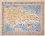
Index map for Hispaneola.
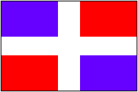
67-10581-NE1804
Gonaives (Cap Haitien) NE-18-04.
$17.99
67-10581-NE1807
Les Cayes - NE-18-07.
$17.99
67-10581-NE1808
Port au Prince - NE-18-08.
$17.99
67-10581-NE1901
Santiago - NE-19-01. Folded.
$17.99
67-10581-NE1902
San Francisco de Macoris - NE-19-02. Folded.
$17.99
67-10581-NE1905
NE-19-05. Folded.
$17.99
67-10581-NE1906
Santo Domingo - NE-19-06. Folded.
$17.99
67-10581-NE1907
La Romana - NE-19-07. Folded.
$17.99
Haiti & Dominican Republic Topographic Map Series - 1:50,000.