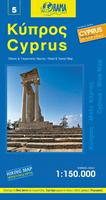
Cyprus Road Map. 1:150,000. Orama Editions, 2011. A detailed road map covering all of Cyprus. The map uses detailed 1:150,000 road mapping with countour lines to show elevation. Distances are marked along the roads, numerous symbols locate tourist sites and services. Indexed with multilingual legend. Size is 27 (70cm) x 39 (98cm) inches when unfolded.
$15.99
64-45909
1 sheet, folded.
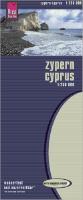
Waterproof! Cyprus Travel Map. 1:250,000. Reise Know-How. This map combines topographic mapping with road detail and tourist information. Road information is clear and the relief is presented by contours, spot heights and altitude tinting. Town names are in both Latin and Greek script. Intermediate driving distances are marked and railways, oil pipelines, aqueducts, swamps, border crossings and administrative boundaries are marked. Symbols show oases, wells, campsites, pyramids & other places of interest. Longitude & latitude lines are drawn at 10' intervals. With an index of place names.
Cyprus Road Map. 1:250,000. Selas, Nicosia. Includes over 7,000 entries and explanations and legend in six languages (English, French, German, Swedish, Greek and Russian). It is revised every year and is the best-selling map in Cyprus. A very comprehensive map with information on historical and cultural sites, geomorphological landforms, classification of settlements according to population and tourist information (accommodation, picnic sites, camping, popular beaches, etc).
Size 90x60cm, folded. Includes maps of Nicosia, Limassol, Larnaka, Pafos, Agia Napa, Protaras, Hill Resorts and Nature Trails and index to places of interest and hotels.
Sample from the map.
$15.95
64-45904
1 sheet.
Cyprus Regional Road Map Series. 1:100,000. Orama Editions, 2011. This detailed road map series covers Greek Cyprus, but not Turkish Cyprus. The map utilizes the same cartography as in the spiral-bound atlas above. The map countour lines to show elevation. Distances are marked along the roads, numerous symbols locate tourist sites and services. Indexed with multilingual legend. Size is 27 (70cm) x 39 (98cm) inches when unfolded.
$15.99
64-4562-AG
Agia Napa map.
$15.99
64-4562-LA
Larnaca map.
$15.99
64-4562-LI
Limassol map.
$15.99
64-4562-NI
Nicosia map.
$15.99
64-4562-PA
Paphos map.
Cyprus District Road Maps. 1:100,000. Survey Department. These are black/white/blue maps that show roads and villages overprinted on a drainage base map. Many of the roads have road/highway numbers and distances.
Sample of a 6" x 6" section.
$33.99
64-4545-01
Famagusta (Ammochostos), 2 sheets flat.
$12.95
64-4545-02
Kyrenia, flat.
$12.95
64-4545-03
Larnaka, flat.
$12.95
64-4545-04
Lefkosia (Nicosia), flat.
$12.95
64-4545-05
Limassol, flat.
$12.95
64-4545-06
Pafos, flat.
Limassol Street Atlas. Selas, Ltd, Nicosia. In Greek. Includes over 11,000 entries and explanations and is fully comprehensive, with 58 road maps of Limassol town and its suburbs. It also includes a 109-page index of all street names with their postal codes and a 10-page index of useful information on churches, schools, libraries, cinemas, theaters, cultural centers, embassies etc. Size 13.5x19.5 cm. 192 pages, 58 color maps, alphabetical list of streets and postal codes, churches, schools, embassies government offices etc.
Sample detail from the atlas
$44.95
644592LJ
Atlas.
Nicosia Street Atlas. Selas, Ltd, Nicosia. In Greek. Includes over 12,000 entries and explanations and is fully comprehensive, with 93 road maps of broader Nicosia town and its suburbs, including Latsia, Lakatamia, Geri, Tseri and Dali. The street atlas is continuously revised and includes a 166-page index of all the street names with their postal codes and a 17-page index of useful information on churches, schools, libraries, cinemas, theaters, cultural centers, embassies, sports grounds etc. Size 13.5x19.5 cm. 292 pages, 93 color maps, alphabetical list of streets and postal codes, churches, schools, embassies government offices etc.
Sample detail from the atlas
$44.95
64-4592NJ
Atlas.
Cyprus City Street Maps. Variable scales. Orama Editions, 2011. Map size is 27 (70cm) x 39 (98cm) inches when unfolded.
$14.99
64-4592LAR
Larnaca. 1:7,500.
$14.99
64-4592LIM
Limassol. 1:7,800.
$14.99
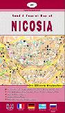
64-4592NIC
Nicosia. 1:7,500.
$14.99
64-4592PAP
Paphos. 1:9,000.
Cyprus City Maps. Selas, Nicosia. Each map includes comprehensive index.
Sample from the map.
$15.95
64-4592NI
Nicosia Street Map. Selas, Nicosia. 3rd ed. Includes street map of broader Nicosia, index to all place names, hotels, places of interest, etc. Size is 98 x 67cm.
$12.95
64-4592AG
Agia Napa, Protaras, Paralimni Street Map. Includes street map of Agia Napa, Protaras, Paralimni. Size is 49 x 68cm.
$15.95
64-4592LD
Larnaka Street Map. Selas, Nicosia. Includes street map of broader Larnaka town. Size is 80 x 62cm.
$15.95
64-4592LI
Limassol Street Map. Selas, Nicosia. 2nd ed. Includes street map of Limassol town, Agios Athanasios, Agia Fyla, eastern Limassol beach area. Size is 85 x 60cm.
$15.95
64-4592PC
Pafos Street Map. 1:7,500. Selas, Nicosia. 4th ed. Includes street map of Pafos town and Pafos district (1:100,000). Size is 50 x 70cm.
Quarters of Larnaka Map. This map shows the boundaries of the "Quarters" of the city of Larnaka. The map also shows streets, but lacks street names.
$12.95
64-4592LC
1 sheet, flat.
Cyprus Topographic Maps
Cyprus 1:250,000 Topographic Map (JOG NI-36-3). 1:250,000. 1990. A single-sheet JOG topographic chart that covers all of Cyprus. JOG number NI-36-3.
Thumbnail of the map. Detail from the map.
$14.95
64-45501
1 sheet, flat.
Cyprus Administration and Road Map (Physical Map). 1:250,000. 1996. This map makes a good road map. The map has 100 meter contours and hypsometric coloring, plus showing roads, distances, etc.
Thumbnail of the map. Detail from the map.
$7.95
64-4547
1 sheet, flat.
Cyprus Administration and Road Map (Political Map). 1:250,000. 1995. Colored to show administrative districts, roads, distances, etc.
Detail from the map.
$7.95
64-4548
1 sheet, flat.
Cyprus 1:250,000 Topographic Map (Kibris). 1:250,000. Harita Genel Komutanligi, Turkey. 1st ed. June, 1987. A good quality topographic map; in English/Turkish.
$14.95
64-4550
1 sheet, rolled
Cyprus Topographic Map. 1:100,000. 1997. This is an excellent, large-scale 4-sheet topographic map of Cyprus. With 100-meter contours. Recommended.
Detail from the map.
Cyprus Mineral Resources Map. 1:250,000. CGG. Shows the mineral resources marked on a generalized geologic base map. 89 x 58 cm.
$11.95
64-4540
1 sheet, rolled
Cyprus Groundwater Quality Map of Nicosia-Larnaca-Limassol Region (3 sheets). 1:100,000. 1985. Only one sheet is still available of this set.
$9.95
64-4577-03
Suitability of Groundwater for Irrigation.
Geography of Cyprus - 5 volume set. 1:250,000. Selas, Ltd, Nicosia. In Greek. Book size is 17 x 24 cm.
Volume 1: Physical Geography of Cyprus. Includes important chapters on the geomorphology, geology, fauna and flora, the hydrology of Cyprus, the Cypriot beaches etc. 152 pages, 17 maps, 7 plans, 37 color photos.
Volume 2: Historical, Political and Cultural Geography of Cyprus. Includes important chapters on the historic and geographical aspects of all historical periods of Cyprus from the Neolithic Period (7,500 B.C.) to the Contemporary Political Geography of Cyprus (Turkish Invasion, Cyprus and international organizations, Cyprus and the European Union). 152 pages, 2 engravings, 2 plans, 11 maps, 25 color photos.
Volume 3: Economic Geography of Cyprus. Includes important chapters that cover all economic sectors, such as agriculture, rural development, forestry, industry, tourism, shipping, commerce, communications and telecommunications etc. 160 pages, 7 maps, 5 graphs, 18 color photos.
Volume 4: Population and Settlements. Includes important chapters on Cyprus demography, employment, fertility and mortality, rural and urban population, minorities, emigration etc. 160 pages, 12 maps, 3 charts, 12 color photos and many statistical figures.
Volume 5: Geographical Regions of Cyprus. This volume examines the five major geographical regions of Cyprus and its 24 subdivisions as per their physical, cultural, economical and historical aspects. 160 pages, 11 maps, 18 color photos.
$129.95
64-4544
5 volume set.
Cyprus Distribution of Population by Ethnic Group Map. 1:250,000. 1976, using 1960 data. Shows positions of invading Turkish forces plus the percentage of economic resources controlled by the Turks.
Thumbnail of the map. Detail from the map.


 Waterproof!

 Thumbnail of the map.
 Reverse side of the map.
 Detail from the map.
 Sample from the map.
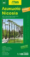
 Sample of a 6" x 6" section.
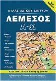
 Sample detail from the atlas
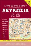
 Sample detail from the atlas
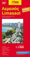
 Sample from the map.
 Thumbnail of the Larnaka map
 Detail from the Larnaka map
 Thumbnail of the Morphou map
 Detail from the Morphou map
 Thumbnail of the Dhali map
 Detail from the Dhali map
 Thumbnail of the map.
 Detail from the map.
 Thumbnail of the map.
 Detail from the map.
 Detail from the map.
 Detail from the map.
 Thumbnail of the map.
 Detail from the map.
 Thumbnail of the map.
 Detail from the map.