|
|
Belarus Travel Maps & Atlases
(Belarus) Minsk Regional Map. 1:200,000. GUGK. 1991. A 1:200,000 topographic map centered on Minsk. In Russian.
Belarus Topographic & Physical MapsBelarus 1:50,000 Topographic Quadrangle Maps. 1:50,000. Russian government. Very high quality topographic maps with excellent detail. Complete coverage of Belarus in 721 sheets. Available only as digital maps. In Russian.
Belarus Political Map. 1:1,000,000. Belkartographia. Shows roads, major political boundaries, railroads, airports, etc. In russian.
Belarus Political Map. 1:500,000. Belkartographia. A more detailed version of the map above. Shows roads, major political boundaries, railroads, airports, etc. Laminated. In Russian.
Belarus Physical Map. 1:500,000. Minsk Cartographic Factory, 1995. A hypsometric map that hows roads, major political boundaries, railroads, airports, etc. In Russian. Approx. 56 x 46".
Belarus City Topographic Maps. 1:10,000. USSR. 1987. Military city topographic map; in Russian. Raster maps only, paper maps not available.
|
||||||||||||||||||||||||||||||||||||||||||||||||||||||||||||||||||||||||||||||||||||||||||||||||||||||||||||||||||||||||||||||||||||||||||||||||||||||||||||||||||||||||||||||||||||||||||||||||||||||
 Belarus Maps and Atlases
  Grand Historical Atlas of Belarus, volume 1. BELKA, 2008.

 Thumbnail of the front of the map
 Sample detail from the Belarus map
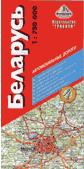
 Sample detail of the Belarus Travel Map
 Sketch showing map coverage.

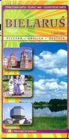
 Sample detail of the Belarus Tourist Map
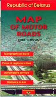


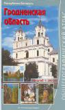
 Sample from the Grodno atlas.
 Fishing and Hunting Atlas of Minsk Oblast. Belkartografia. No date. In cyrillic. The atlas contains 36 pages of physical maps at 1:200,000 - each showing public lands where hunting or fishing is allowed. Also included are 12 pages of lake maps with water depths. Softcover, ISBN 985-6625-29-7.

 Belarus City Street Atlases. No scale. Belkartografia, 2005. In cyrillic. These atlases contains detailed street maps for each city, showing street/block addresses, gas stations, parking areas, banks, and much more. Extensive index includes streets, schools, gyms, restaurants, etc. Softcover.

 Sample of the Minsk map.
 Sample of the Homyel' city map
 Sample


 Belarus Flags