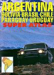
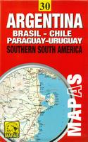
Southern South America Atlas (Atlas de Rutas). Firestone/Zagier & Urruty, 2015.
2015 edition of the most complete and updated atlas available for Argentina and surroundings (Chile, Bolivia, Uruguay, Paraguay and south of Brazil). Includes more than 168 city plans and 230 road maps, hotel and campsite lists, etc. Produced locally by Argentina experts and travelers. 220 pages, center-stapled soft-cover. ISBN 978-9872855932.
Sample detail from the city maps in the Atlas de Rutas. Sample detail from the road maps in the Atlas de Rutas.
66-2488-2015
Atlas.
$31.99
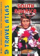
South America Road Atlas. 1:3,000,000. ITMB.
All of the continent of South America is now available in an easy-to-read, easy-to-use, easy-to-store road atlas at a superb scale. In addition to showing each country systematically, logically, and in great detail, physical features, points of interest, beaches, reefs, parks and reserves, major airports, and roads are shown. The atlas is 5 1/2" wide by 8 1/2" high (15cm x 22cm). This atlas is 112 pages in length, is fully indexed, and has a hard card cover, and a spine.
66-2489
Atlas
$19.95
Argentina Road Maps - Waterproof Maps
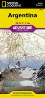
Waterproof! Argentina Adventure Map. 1:2,300,000. National Geographic Maps.
The north side of the Argentina map details the most highly populated areas of the country including the provinces of Buenos Aires, Córdoba, and Santa Fe as well as the impressive landscape of the Cordillera de los Andes bordering Chile on the northwest. Vineyards in Mendoza, Argentina's world-renowned wine producing province are included, as are ski areas in this popular tourist region. An inset map shows the small province of Misiones that juts into the neighboring countries of Brazil and Paraguay. The south side of the map details Argentina's extensive coastline from Mar Del Plata to Tierra Del Fuego highlighting beaches, preserves, and areas noted for fishing and surfing. Size is 25 x 38 inches unfolded.
Sample detail from the Argentina Adventure Map. Image of the front of the Argentina Adventure Map. Image of the back of the Argentina Adventure Map.
64-12911
1 sheet, folded.
$11.95
Laminated! Argentina Travel Map. 1:3,800,000. Borch.
Borch's soft-laminated folded map of Argentina shows: Argentina 1:3,800,000, Isla Grande de Tierra del Fuego 1:1,900,000, Los Glaciares National Park 1:750,000, Mount Fitz Roy 1:250,000, Greater Buenos Aires 1:650,000, Buenos Aires 1:18,000, Cordoba 1:14,000, Salta 1:16,000, Argentina administrative and time zones. The map is durable and water-repellent with a wipeable surface. The map shows hotels, museums, monuments, markets, public transport, top sights and points of interest, useful statistics, conversion charts for temperatures, weights and measurements, climate charts showing temperatures, sunshine hours, precipitation and humidity, overview maps, time zones, and much more...
Sample detail from the Argentina travel map Image of the front of the Argentina travel map image of the back of the Argentina travel map
64-12905
1 sheet, folded.
$11.95
Argentina Road Maps - Paper Maps
Argentina Road Map. 1:4,000,000. ITMB, Canada.
Popular road map of Argentina. The map uses color tinting to show elevation, has a detailed road network, and includes tourist sites and services such as airports, etc.
64-1290
1 sheet, folded
$12.95
Argentina / Chile Travel Map. 1:2,000,000. Michelin #788.
Detailed road map of Argentina and Chile in the famous Michelin style. The map includes places of interest, a full index of place names, and a Buenos Aires city map.
Sample detail of the Argentina Travel Map
64-12909
1 sheet, folded.
$12.95
Argentina Tourist Map. 1:2,000,000. Mapas NaTurismo, 2012.
A superb, detailed, double-sided shaded relief travel map of Argentina. The map clearly notes the reserves and parks, visitor centers, major estancias, tourist sites such as caves, fishing beaches, etc., The map shows the locations of gas stations, airports, distances along main roads, spot heights, and much more. Multilingual legend, including English. ISBN 9783981126990.
Sample detail of the Argentina Tourist Map
64-12913
1 sheet, folded.
$12.99
Argentina Road Map (Rutas de la Argentina). 1:2,500,000. Automapa.
With inset maps of 20 cities. Bilingual.
64-12902
1 sheet, folded.
$12.99
Argentina & Southern South America Road Maps - Paper Maps
Argentina and Southern South America Map. 1:4,000,000. JLM Mapas, 2011.
A new edition of his 1998 map, covering the southern part of South America. This double-sided map
Sample detail of the Southern South America map
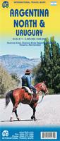
Northern Argentina & Uruguay Travel Map. 1:2,200,000 / 1:800,000. ITMB.
The map shows Argentina on one side and Uruguay on the reverse. The maps show Roads by classification, Airports, Ferries, Train Stations, Bus Terminals, Subway Stations, Lighthouses, Beaches, Ruins, Hot Springs, Border Crossings, Points of Interest, Police Stations, Gas Stations, Museums, Churches, Post Offices, Department Stores, Theatres, Restaurants, Hospitals and more. Insets include: Buenos Aires, Buenos Aires Region, Cordoba, Rosario, Montevideo, Punta Del Este, and Colonia Del Sacramento.
Sample detail of the Argentina/Uruguay Map
64-12916
1 sheet, folded.
$12.95
Southern Argentina & Tierra del Fuego Travel Map. 1:2,200,000 / 1:750,000. ITMB.
Throughout this long strip of a combination of mountains, seas, and forests, tourists will find this land to be unique and natural. On the other side of this map and at the very end of the two countries sits the famous Land of Fire island, Tierra del Fuego. This triangle shaped island is both part of Chile and Argentina and has been a desirable tourist destination. We have also included an inset map of Ushuaia, "the southernmost city in the world" that is closest to the South Pole. This is the same Tierra del Fuego map as the 64-12711 below.
Sample detail of the Argentina/Tierra del Fuego Map
64-12917
1 sheet, folded.
$12.95
Litoral Regional Road Map - Northeastern Argentina. Firestone.
Detailed double-sided road map of the rivers region of NE Argentina, Uruguay, and southern Paraguay - Rio Uruguay, Rio Parana, Rio Paraguay, Rio de la Plata, etc.. The map includes small inset city-center street maps of the main cities in the region.
64-12715
$12.99
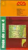
Recommended! Argentina Regional Road Map Series. 1:1,000,000. Automovil Club Argentino. Double-sided regional maps of Argentina. In Spanish.
Regional road map coverage of Argentina.
6 of 9 sheets are available - the rest are due in the coming months.
Superb maps for tourists.
Detailed road map of the region.
Road map shows: national parks, tourist sites and services such as ACA offices, ports, railroads, ruins, dams and lakes, spot heights/elevation, distances between road junctions, and much more.
Zone #4. Buenos Aires north, Cordoba, Corrientes, Entre Rios, San Luis, Santa Fe, Santiago del Estero south. ;
$15.99
64-12895-05
Zone #5. Mendoza, San Luis, Cordoba west, La Pampa north. ;
$15.99
64-12895-06
Zone #6. Buenos Aires region. ;
$15.99
64-12895-07
Zone #7. La Pampa central and south, Neuquen, Rio Negro. ;
$15.99
64-12895-08
Zone #8. Chubut, Santa Cruz north. ;
$15.99
64-12895-09
Zone #9. Santa Cruz south, Tierra del Fuego. ;
$15.99
Argentina Provincial Road Maps. Scales vary. Automovil Club Argentino. These shaded relief maps show roads, cities, villages, streams and rivers, and mileages along the roads. With tourist information and city/village index. In Spanish.
NOTE: Many of these maps are being replaced by the new Zona maps listed above. If you do not see the province listed below, check above.
Index showing coverage of each sheet.
64-12901
Argentina. 1:4,000,000.
$15.99
64-1248-01
Buenos Aires. 1:1,100,000. - Replaced by 64-12895-06 above.
64-1248-02
Catamarca. 1:1,100,000.
$13.99
64-1248-03
Chaco Formosa. Now out of print, we have one copy left in stock. 1:1,000,000.
$13.99
64-1248-09
Jujuy and Salta. 1:1,100,000.
$15.99
64-1248-12
La Rioja. 1:1,100,000.
$15.99
64-1248-14
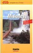
Misiones. 1:500,000.
$13.99
64-1248-16
San Juan. 1:1,000,000.
$15.99
64-1248-17
San Luis. Now out of print, we have 3 copies left. 1:400,000.
$15.99
64-1248-20
Santiago del Estero. 1:1,000,000.
$13.99
64-1248-22
Tucuman. 1:400,000.
$15.99
Argentina Provincial Road Map. Automapa. Bilingual road maps covering some of the most popular tourist regions of Argentina.
64-12751
Buenos Aires province map.
$15.99
64-12754
Entre Ríos province. 1:530,000.
$15.99
64-12758
La Pampa province.
$15.99
64-12759
Santa Fe province. 1:925,000.
$15.99
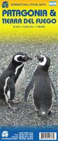
Patagonia & Tierra del Fuego travel map. 1:2,000,000 / 1:750,000. ITMB. Patagonia & Tierra del Fuego are undergoing rapid infrastructure improvements. Large stretches of famed Hwy 40 have now been paved, and new cross-highways are either paved or in the process of paving all over the territory. Chilean Patagonia (or more properly the Austral) is also seeing much-needed road improvements. The Tierra del Fuego island area is also seeing massive improvements, with a new airport, cruise ship facility, and a fully-paved highway to the Chilean border. Double-sided, printed on paper.
Detail of the Patagonia travel map
64-12711
1 sheet, folded. Paper.
$12.95
Patagonia Travel Map. 1:2,750,000. InfoMAP & Zagier & Urruty. Handy-sized laminated road map of the region. One side includes a map of all of Patagonia (1:2,750,000) while the reverse has maps of the Lakes District (1:1,400,000), Peninsula Valdes (1:1,200,000), and Austral Patagonia (1:1,400,000).
64-12713
1 sheet, folded
$14.99
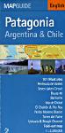
Patagonia Guide Map. 1:3,300,000. de Dios. A useful tool to discover this fascinating region. From what is known as The End of the Earth in Tierra del Fuego, till the natural beauty of the Seven Lakes region. Then Puerto Madryn, Chiloé, El Calafate, El Chaltén, Pucón, Bariloche, the legendary Route 40, Butch Cassidy's steps, the National Parks, the Dino's Park, the ski resorts. Such names and words can only bring us back to adventures, sports, and legends.
Also, all the information about charming hotels, "estancias" open to tourism, restaurants where to taste the regional dishes, tips, travel advices and more... to start living unforgettable days in Patagonia. Map size is 45 x 68 cm, in English.
Laminated! Buenos Aires Street Map. 1:15,000. Borch. Borch's soft-laminated folded map of Buenos Aires shows: Buenos Aires Centre 1:15,000, Isla Martín Garcia 1:18,000, Núnez 1:15,000, Boca 1:15,000, Buenos Aires 1:75,000, Greater Buenos Aires 1:530,000, Argentina Central 1:3,000,000, Public Transport Buenos Aires, Argentina administrative and time zones, Top 30 Sights. Borch Maps are easy to fold, durable and water-repellent with a wipeable surface. Borch Maps show hotels, museums, monuments, markets, public transport, top sights and points of interest, useful statistics, conversion charts for temperatures, weights and measurements, climate charts showing temperatures, sunshine hours, precipitation and humidity, overview maps, time zones, and much more...
Sample detail from the Borch Buenos Aires city map Image of the front of the Borch Buenos Aires city map Image of the reverse of the Borch Buenos Aires city map
64-1292BC
1 sheet, folded
$10.95
Waterproof. Buenos Aires and Northeast Argentina map. 1:12,500 / 1:2,200,000. ITMB. A waterproof travel map with a detailed map of central Buenos Aires on one side. A road map of northeast Argentina is on the reverse, covering from Iguacu Falls in the far north to Bahia Blanca and Mar del Plata in the south, and Cordoba in the west.. Map size is 27 x 39".
Sample detail from the Borch Buenos Aires city map
64-1292BE
1 sheet, folded.
$12.95
Buenos Aires street & subway map. 1:18,000. de Dios.
This is a more basic, less expensive map, pocket map that lacks the tourist information of the map above. This street map covering the following Districts: Abasto, Almagro, Barracas, Barrio Norte, Belgrano – Centro, Chacarita, Colegiales, Congreso, Constitución, La Boca, Las Cañitas, Monserrat, Nuñez, Once, Palermo, Palermo Hollywood, Palermo Viejo, Puerto Madero, Reserva Ecológica, Recoleta, Retiro, San Telmo, Viila Crespo.
Also a subway map, index of all the streets covered, attractions, points of interest, museums, parks,etc., and useful phones. Laminated. Map size is 22.5 x 68 cm. In English/Spanish.
64-1292BR
1 sheet, folded.
$8.95
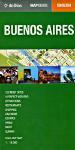
Buenos Aires map & guide. 1:18,000. de Dios.
This is a map with additional tourist information. Map information includes attractions, museums, walking tours, restaurants, night life, shopping, escapes, a perfect weekend plan, experiences that are a must, and acommodations and the most important spots in the city.
The 101 musts in Buenos Aires, from Jorge Luis Borges' preferred cafe to the trendy stores, the best commercial areas, and the milonga bars to dance tango, fashion, restaurants. 70 Unique experiences enabling you to know the "porteño" spirit.
The maps also include subway map, telephones, airports, and useful information. Map size is 45 x 68 cm. In English.
64-1292BP
1 sheet, folded.
$11.95
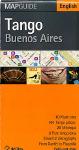
Buenos Aires Tango map. 1:21,000. de Dios, 2003.
101 Key places in Buenos Aires tango life: the best milongas, Gardel's house, Piazzolla's favorite cantina, stores to get unique recordings, the best academies, and the bohemian bars.
3 Pure Tango Days. A schedule, hour by hour, to live three days in an absolute tango way.
Essential discography: A vast and detailed discography from the origins of the Guardia Vieja period to the post-Piazzolla vanguard.
20 Milongas: From the quiet downtown dance floors of the city, ideal to learn how to dance, to the tango spots of Villa Urquiza, chosen by the most famous milongueros.
64-1292BT
1 sheet, folded.
$8.95
Argentina City Maps. ACA and Automapa. Road and city maps with information on hotels, etc. In Spanish.
64-1291CO
Cordoba with city center map. 1:1,562,500 + city center map.
$10.95
64-1292CO
Comodoro Rivadavia.
$10.95
64-1292LA
La Plata city map. #02.
$15.99
64-1292MB
Mar del Plata. 1:30,000.
$15.99
64-1292ME
Mendoza.
$13.99
64-1292RO
Rosario. 1:30,000.
$13.99
64-1292SM
San Miguel de Tucuman.
$10.95
Rio Grande City Map, Tierra del Fuego, Argentina. Pablo Bordignon, 2000. A small (15 x 19") tourist map of the city, including tourist information such as hotels, hospitals, etc. In Spanish.
64-1292RG
1 sheet, folded
$5.95
Tolhuin City Map, Argentina. Pablo Bordignon, 2000. A small (15 x 19") tourist map of the city, including tourist information such as hotels, hospitals, etc. In Spanish.
64-1292TO
1 sheet, folded
$5.95
Ciudad de Ushuaia City Plan. No scale. Pablo Bordignon. This is a tourist street map of the main part of Ushuaia, the southernmost city in South America. The map includes symbols showing the location of tourist services such as movie theaters, restaurants, government buildings and much more. A street index is also included. The reverse side has a listing of hotels, a brief history of the town, and more. Bilingual.
64-3992US
1 sheet, folded.
$7.99
Argentina Hiking Maps
Cerro Aconcagua Hiking Maps
Recommended Aconcagua hiking/topographic maps by Aoneker. With latitude/longitude and UTM grids (WGS84). These maps often use a satellite image as a basis for their maps, interpreting areas of snow, bare ground, vegetation and cultural features. Then they overlay contour lines, numerous spot elevations, roads, camping huts, etc. Typical size is 16½ x 23½".
Sample buttons below offer thumbnail views of the entire map.
64-1277-01
Aconcagua. 1:50,000. Covers the main part of the mountain. Topographic map with 25 meter contours, no route information, essentially a zoomed view of the 1:100.000 map with the labels reduced in size. Better for an ascent. In English.
$22.95
64-1277-02
Aconcagua. 1:100,000. Covers the mountain and the approaches. Topographic map with 25 meter contours, no detailed route information. Shows the mountains around Aconcagua, ice climbing in Portillo, sport climbing in Las Cuevas. In English.
$15.99
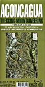
Aconcagua trekking-mountaineering topo map. 1:50,000. Zagier & Urruty.
The biggest and most up-to-date trekking map for Aconcagua Provincial Park, in Mendoza, Argentina. Satellite relief, contour lines, timed trails, shelters, camping and services. Size is 72 x 102 cm.
64-1273
1 sheet, folded.
$12.99
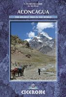
Aconcagua and the Southern Andes Hiking Guide. Cicerone Press.
Guidebook to climbing Aconcagua, with route descriptions for trekkers to the Normal and Vacas Valley Routes. They take 12 and 14 days to complete respectively and cover a variety of difficult mountain terrain up to 6962m - suitable for experienced walkers and mountaineers. Also included are treks in the Vallecitos and Tupungata ranges.
64-12951AC
1 sheet, folded
$24.95
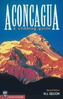
Aconcagua - A Climbing Guide. By R.J. Secor. The Mountaineers Books.
27 routes from three major approaches.
Thoroughly researched advice on lodging, permits, equipment, seasons, weather and more.
The only English-language guidebook to South America's highest mountain.
Reaching the highest summit in the Western hemisphere requires careful preparation and detailed instruction. R. J. Secor draws upon his extensive mountaineering experience to give climbers all that's necessary to top Aconcagua's 22,841-foot peak. This updated and revised guide features comprehensive information on recommended equipment, safety and health precautions, and conservation issues. It details both the popular and less-traveled routes reached via the Horcones Valley, South Face, and Vacas and Relinchos Valleys. Also included are a climbing history of Aconcagua and a glossary of valuable Spanish mountaineering phrases.
64-1296MA
Guide
$16.95
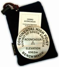
Cerro Aconcagua benchmark paperweight. Geo-Situ. Whether you're a climber, hiker, geography buff, or armchair traveler, you'll love to collect or give these unique bench mark paperweights that celebrate the spirit of exploration, athletic challenge, and personal achievement. Cast in pewter these summit marker paperweights are the same diameter as and in the style of official USGS benchmark markers. Please click the "sample" button below to see an enlargement of the paperweight. Each marker has a soft felt pad on the bottom so these can be used on glass, wood, or any surface. Supplied in a soft fleece drawstring pouch, 3¼" diameter.
Larger image of the Aconcagua paperweight.
64-1297AC
Paperweight.
$59.95
Click here to see poaperweight stands and additional paperweights.
Argentina Hiking Maps for Other Areas
Travel Maps of Northwest Argentina. Asiru, Argentina. This new series of maps covers the most popular tourist areas in northwest Argentina, in the area of Salta, Tucuman, and Jujuy. The maps have a satellite image map on one side and a physical map on the reverse. The physical map has elevation coloring, latitude/longitude tick marks in the margins, roads and road information, distances, and points of interest. Map size open is 12 x 18 inches. Bilingual English/Spanish.
Samples of the maps Sample #2 of the maps
64-12725-DIQ
Dique Cabra Corral. Popular lake located in central Salta Province.
$5.95
64-12725-QUE
Quebrada de Humahuaca. Map covers most of Jujuy Province.
$5.95
64-12725-SAL
Salinas Grandes. Covers the great salt flats that cover nearly 200 km sq in parts of Jujuy and Salta Provinces.
$5.95
64-12725-TRE
Tren a las Nubes (Train to the Clouds). Covers this popular train route from Salta up to the Viaducto la Polvorilla at over 13,000 feet elevation.
$5.95
64-12725-VCN
Valle Calchaquí Norte. This map covers the northern part of the Calchaquí valleys that cover much of central and southern Salta Province and most of Tucuman Province.
$5.95
64-12725-VCS
Valle Calchaquí Sur. This map covers the southern part of the Calchaquí valleys that cover much of central and southern Salta Province and most of Tucuman Province.
$5.95
Train and Road to the Clouds Map and Guide set (Tren y Ruta a las Nubes). Asiru, Argentina. This guide and map set covers the popular road/train route from the city of Salta to the Viaduct la Polvorilla at over 13,000 feet elevation. The guide discusses topography, soils, geology, vegetation, wildlife, archeology, local culture, etc. The guide describes both the train route (along Ramal C-14)road (along Route 51). With 12 small folded maps. Bilingual.
Samples of the maps Sample #2 of the maps
64-12722
1 set, folded
$19.99
Argentina Political and Physical Maps
Argentina Physical Wall Map. 1:2,500,000. IGM. 1999. A detailed two-sheet physical map of Argentina. Hypsometric contours show elevation. Major roads are also shown on the map. In Spanish.
64-12492
2 sheets, rolled.
$24.95
Argentina Political Map (Mapa Politico). 1:5,000,000. IGM. In Spanish.
64-12490
1 sheet
$14.95
Argentina Physical Map (Mapa Fisico). 1:5,000,000. IGM. In Spanish.
64-12491
1 sheet
$14.95
Argentina Flags
Argentina Flags
67-1070ARG
Argentina flag, small. Size 4 x 6 in.
$5.99
67-1071ARG
Argentina flag, medium. Size 8 x 12 in.
$9.95
67-1073ARG
Argentina flag, large. Size 2 x 3 ft.
$44.95
Argentina Geology and Thematic Maps
Argentina--Geologic Map (Mapa Geologico de la Republica Argentina). 1:5,000,000. AGS. 1964. One sheet, in Spanish.
64-1201
1 sheet, rolled
$19.95
Argentina--Provincial Mineral Maps. 1:750,000. 1966-1979. ASG. In Spanish. These maps give the most complete coverage of Argentina of any geo-thematic map series.
NOTE: These are now out of print and we have only one province map left in stock.
64-1241-CB
Catamarca and Tucuman. 1966.
$29.99
Argentina Geologic Quadrangle Maps. 1:200,000. AGS. Many of these maps are now out of print and more go out of print every year. Each map includes a separate text of 15-100 pages. In Spanish.
64-1255-098
Bull. 98. Descripcion geologica Hoja 25a, Volcan San Jose (Prov. Mendoza).
$19.95
64-1255-108
Bull. 108. Descripcion geologica Hoja 35a, Lago Alumine (Prov. Neuquen).
$19.95
64-1255-128
Bull. 128. Descripcion geologica de la Hoja 24ab, Cerro Tupungato (Prov. Mendoza).
$19.95
64-1255-135
Bull. 135. Descripcion geologica de la Hoja 30e, Mendoza La Pampa (Prov. Mendoza La Pampa).
$19.95
64-1255-140
Bull. 140. Descripcion geologica de la Hoja 58b, Lago Argentino (Prov. Santa Cruz).
$19.95
64-1255-152
Bull. 152. Descripcion geologica de la Hoja 32c, Buta Ranquil (Prov. Mendoza-Neuquen).
$19.95
64-1255-173
Bull. 173. Descripcion geologica de la Hoja 31d La Matancilla (Prov. Mendoza).
$19.95
Geologic Maps of the Provinces of Argentina (Mapa Geológico de la Provincia de ...). Scales vary. Dates vary. These maps are one-sheet maps, in color. The margins contain map legends, some inset maps, and some descriptive text. In Spanish.
NOTE: Now out of print, we have only one province map left.
A portion of the Rio Negro map


 Sample detail from the city maps in the Atlas de Rutas.
 Sample detail from the road maps in the Atlas de Rutas.

 Waterproof!
 Sample detail from the Argentina Adventure Map.
 Image of the front of the Argentina Adventure Map.
 Image of the back of the Argentina Adventure Map.
 Laminated!
 Sample detail from the Argentina travel map
 Image of the front of the Argentina travel map
 image of the back of the Argentina travel map
 Sample detail of the Argentina Travel Map
 Sample detail of the Argentina Tourist Map

 Sample detail of the Southern South America map
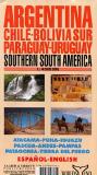

 Sample detail of the Argentina/Uruguay Map
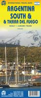
 Sample detail of the Argentina/Tierra del Fuego Map
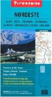

 Recommended!
 Image of the front of Zone #2 road map
 Image of the back of Zone #2 road map
 Image of the front of Zone #9 road map
 Image of the back of Zone #9 road map
 Sample #1 of a road map
 Sample #2 of a road map
 Sample of a city map


 Index showing coverage of each sheet.
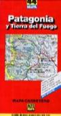 Argentina Provincial Road Map. Automapa. Bilingual road maps covering some of the most popular tourist regions of Argentina.

 Detail of the Patagonia travel map
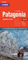

 Sample from the Buenos Aires #7 map
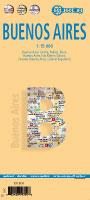 Laminated!
 Sample detail from the Borch Buenos Aires city map
 Image of the front of the Borch Buenos Aires city map
 Image of the reverse of the Borch Buenos Aires city map
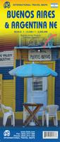 Waterproof.
 Sample detail from the Borch Buenos Aires city map
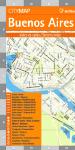


 Recommended


 Larger image of the Aconcagua paperweight.
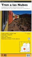
 Samples of the maps
 Sample #2 of the maps
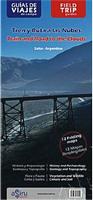
 Samples of the maps
 Sample #2 of the maps
 A portion of the Rio Negro map