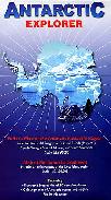
Recommended Antarctica Explorer Map. Ocean Explorer Maps, UK. This excellent series of maps are ideal for students and the classroom. While not really usable as a road map, the extensive historical, biological, and geographic information makes these maps extremely useful.
Generalized shaded relief maps, often with roads.
Illustrated biographies of the major explorers of the region.
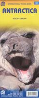
Antarctica Travel Map. 1:8,000,000. ITMB. Single sided travel map with text around the margins. The text describes the fauna, physical characteristics and exploration of Antarctica. The map uses color shading to show water depth and and elevation and ice thickness is noted. Unfortunately latitude and longitude grid/tick-marks are not shown on the map. 97 x 68 cm.
$12.95
66-1951
one sheet, folded.
The Arctic and Antarctica Map. 1:10,000,000. British Antarctic Survey #Sheet 1, 2007. This map, prepared for the Internatinoal Polar Year 2007-2008, is a good summary map of both poles. Side one is a topographic map of the Arctic; including bathymetry, elevation, major rivers, lakes and ice. It shows major towns, transport networks, airports and national boundaries. Coverage limits are 90°N - 60°N.
Side two is a topographic map of Antarctica; including bathymetry, elevation, ice/rock limits, ice shelves and scientific research stations. Coverage limits are 90°S - 60°S.
Arctic map sample Image of both sides of the Arctic/Antarctica map
Antarctica continent map. Zagier & Urutty. Offers a good view of the entire continent.
$12.99
66-19701
Each, folded
Best elevation map Antarctica Topographic Map (GNC Chart #26). 1:5,000,000. NIMA. Shaded relief with spot elevations; no contours. A decent map of Antarctica.
$19.99
67-10567GN26
1 sheet, folded
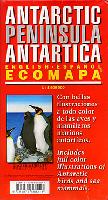
Antarctica: The Last Frontier guide. Luis Bertea Rojas. A wonderful souvenir or introduction for a trip to Antarctica, by this well-known South American photographer. Bilingual throughout, with Spanish and English text side-by-side. 100 pages, more than 125 photographs, softcover, 24 x 19 cm closed.
Click here to view a .pdf of parts of the book.
$25.00
66-1995BE
Book.
Shackleton's Expedition to Antarctica
Sir Ernest Shackleton's 1914-1916 voyage with the Endurance is one of the greatest survival adventures of all time. In August of 1914, Shackleton and 27 crew set sail to cross the Antarctic continent on foot. Before reaching the continent the Endurance was trapped in pack ice and slowly crushed. Over the next 20 months Shackleton and the crew managed to survive, culminating in the 800 mile voyage in the 22-foot open lifeboat James Caird to South Georgia Island which led to their rescue. Listed below are some of the best books on the voyage as well as posters printed from original negatives from the voyage.
(Antartica) Shackleton Map Primer. McElfresh, 2002. This map includes reproductions of historic maps relating to Shackleton's Antarctic Expedition. Printed on polyart synthetic paper.
$24.95
66-1987
Each, folded
"Pressure Ridge" Poster. It portrays the trapped Endurance as seen from behind a pressure ridge that developed nearby. This poster is reprinted from original photographs and negatives in the British Royal Geographic Society's archives. Printed on off-white heavy-duty poster paper these prints are ideal for framing.
$18.95
66-1988-PR
1 sheet, flat
Antarctica Topographic, Satellite, and Reference Maps
Antarctica Satellite Image Map. 1:5,000,000. USGS (I-2560). 1995/2000. Excellent Landsat image of Antarctica. 42 x 57 inches (102 x 142 cm). Ideal for a classroom or student's room.
$24.99
66-19741
1 sheet, rolled
Antarctica Satellite Image Map. 1:5,000,000. USGS (I-2284). 1991. Excellent Landsat image of Antarctica. 36 x 55 inches (91 x 140 cm). A "cleaner" looking poster more appropriate for framing than the poster above.
Image of the entire map
$24.99
66-1974
1 sheet, rolled
Antarctica Reference Map. 1:10,000,000. 1986. Auslig, Australia. Illustrates topography, territorial claims, ice shelf, and more. 74 x 83 cm.
$12.95
66-1952
1 sheet, rolled
Antarctica Reference Map. 1:20,000,000. Auslig, Australia. A reduced-size version of 66-1952 above.
$9.95
66-19525
1 sheet, rolled
Antarctica Satellite Image Maps. 1:500,000. Auslig, Australia. Good satellite image map a part of the Australian Antarctic territory.
$9.95
66-1956-05
Southern Prince Charles Mountains.
Physical Map of Argentine Territory (Territorio Nacional de la Tierra del Fuego, Antárctica e Islas del Atlántico Sur). 1:5,000,000. IGM. 1989. Shaded relief map showing Argentine territorial claims to Antarctica and South Atlantic islands. In Spanish.
$10.95
66-19705
1 sheet, rolled
Antarctica Geologic Maps
Antarctica Metamorphic Facies Map. 1:5,000,000. 1980. USSR. With 43-page English text. 125 x 113 cm.
$25.95
66-1905
4 sheets + text
Antarctica Tectonic Map. 1:10,000,000. 1978. USSR. Bilingual with an 81-page English text. 85 x 77 cm.
$18.00
66-1910
1 sheet + text
Antarctica Aeromagnetic Anomaly Map of the Antarctica Peninsula. 1:1,500,000. British Antarctic Survey (Misc. #6).
 Recommended
 Thumbnail of the front of the Antarctica map
 Thumbnail of the reverse of the Antarctica map


 Arctic map sample
 Image of both sides of the Arctic/Antarctica map
 Thumbnail of the map
 Reverse side of the map
 Sample detail of the map
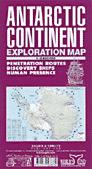
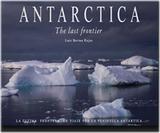
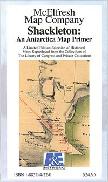
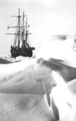
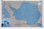

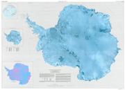
 Image of the entire map