Gecko Maps of the Himalayas, Southeast Asia, and Elsewhere
Gecko Topographic and Tourist Maps. The maps use symbols to show locations of hotels, restaurants, tourist attractions, museums, public buildings, historic sites, scenic views, and each map contains an index for these same topics. Nearly all of the maps include summary climate tables showing monthly temperature and rainfall statistics. All maps are in English or multilingual (including English).
California
Yosemite Valley Hiking Map. 1:24,000 - 1:350,000. Gecko Maps. This attractive map includes three inset maps; on one side is detailed a 1:24,000 topographic hiking map of the main Yosemite Valley showing hiking trails, tourist facilities, etc. On the reverse is a 1:350,000 overview map of the Yosemite National Park, a panoramic map of Yosemite Valley, and a panoramic map of the back side of Half Dome. Bilingual.
Sample of the Yosemite Valley Panorama map Sample of the Valley topographic hiking map Sample of the National Park overview map
62-56743
1 sheet, folded.
$12.95
Cambodia
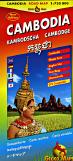
Cambodia Travel Map. 1:750,000. Gecko Maps, 2005. A good road map that gives a clear idea of topography. On one side of the sheet is a map of the whole of the country, with lots of added tourist information such as beach resorts and National Parks. On the reverse are numerous inset maps; central Phnom Penh (1:15,00); the area of Angkor Wat (1:150,000); Siem Reab National Park (1:17,000); Krong Preah Sihanouk & a plan of Sihanoukville (1:20,000). All street plans have a classified index. A latitude and longitude grid at an interval of 30' is superimposed on the main map. Map size is 91 x 66 cm.
Sample #1 from the main road map. Sample #2 from the main road map. Sample from the Angkor Wat inset map. Sample from the Ream National Park inset map. Sample from the Phnom Penh inset map.
65-68903
1 sheet, folded.
$14.99
Angkor City Map. Gecko Maps, 2007. A detailed tourist panorama map of the Angkor area, including coverage of all of the temple complexes. Numerous inset maps highlight the temple complexes and hotel areas. In English.
Limited stock! Meteora Panorama Map. Gecko Maps (formerly Karto Atelier), 1996. A double-sided map with a panoramic map of Meteora on one side and numerous inset maps on the reverse. Descriptive text is in English. Map size is 27 x 22".
Sample of the panoramic map Sample of the inset maps
64-66762
1 sheet, folded.
$16.99
Himalayas, including Nepal
Himalaya & Tibet Map, with Bhutan, Ladakh, and Sikkim. 1:1,600,000. Gecko Maps, 2009. Detailed topographic map showing monasteries, pilgrimage routes, sacred places, holy mountains, and much more. With a 1º latitude/longitude grid for GPS use. Map size is 99 x 148 cm.
Shows area covered by the map Sample #1 Sample #2
65-4372
1 sheet, folded.
$14.99
Chitawan Map. 1:150,000. Gecko Maps (formerly Karto Atelier), 2000. Includes Chitawan National Park, Narayangadh (1:25,000), Hetauda (1:25,000), Sauraha (1:10,000), and a panoramic view map. The map includes a listing of animals most likely to be seen, a table of services offered by resorts outside Sauraha, a summary climate chart. The main map has a 5' latitude/longitude grid for use with a GPS.
Sample #1 of the main map Sample #2 of the main map Sample of an inset city map Sample from the panoramic map
65-04854
1 sheet, folded.
$16.99
Island Peak Hiking Map. 1:20,000. Gecko Maps, A detailed topographic map with coverage extending west from Island Peak to also include Chukung and Chukung Ri peaks. The map has 40-meter contour intervals, spot heights, and shaded relief. There are numerous inset maps; a small panoramic map, an elevation cross section, Chukhung village map, small overview map, and two insets of climbing routes. Also on the map you will find a description of 4 different climbing routes to the summit of the Island Peak (in 6 lenguages; English, German, Italien, French, Nepali and Japanese). With a 1' latitude/longitude grid for use with a GPS.
Sample of the main map Sample of the panoramic map Sample of the climbing routes map
65-04856
1 sheet, folded.
$16.99
Kailash Hiking Map. 1:50,000. A very detailed topographic hiking map with 20-meter contours, spot heights, and relief shading. with an inset map of Darchen (1:4,000) and a small overview map of Tibet at 1:12,000,000. The map indicates different types of terrain and land use: pastures, swamps, glaciers, rocks and gravel. An overprint shows the trekking route around Mount Kailash and highlights various places of interest. Symbols depict such cultural landmarks as monasteries, chortens, prayer flagpoles and ritual sites, also viewpoints, ruins, lodges, shelters and campsites.
The map also includes a small plan of Darchen at 1:4,000. All place names are in both Roman and local script.
Sample #1 of the main map Sample #2 of the main map Sample #3 of the main map Sample of the Darchen city map
Nepal Map. 1:1,000,000. Gecko Maps (formerly Karto Atelier). A decent road map of Nepal, showing elevation, distances between main road junctions, and much more. Elevation is shown with contour lines (500-meter intervals), spot heights, and shaded relief. Inset maps include a 1:250,000 map of Kathmandu Valley, a 1:250,000 map of Pokhara Valley, and a road distance chart. There is a 15' latitude/longitude grid for use with a GPS. Map size is 19.5 x 38".
Sample from the main road map. Sample from the Pokhara Valley map.
65-04906
1 sheet, folded.
$16.99
Lhasa City Map. 1:4,000. Gecko Maps. This is an extremely detailed street map of Lhasa with numerous inset maps. The map highlights traditional Tibetan architecture and townscapes. On side of the map has the main map covering the Old Town, Potala, and other main tourist areas of Lhasa. The reverse side has a large map of Lhasa Old Town, plus eleven inset maps of such places as Potala, Marpori, Greater Lhasa, Temple Jokhang, etc. Descriptive text is included for each map. Map size is 20 x 41".
Sample from the main Lhasa map Sample from the Potala Palace inset map Sample from the Norbulinka Summer Palace inset map
65-4392LK
1 sheet, folded.
$17.99
India
Dharamsala City Map, with McLeodganj. 1:1,700; 1:5,000; 1:20,000. Gecko Maps, 2009. Detailed street map of these cities that hosts the Tibetan government in exile.
Sample #1 Sample #2
64-7695DHA
1 sheet, folded
$20.99
Laos
Laos travel map. 1:600,000. Gecko Maps. Excellent road map of Laos, with 13 smaller inset maps. The inset maps are what make this map - detailed insets of all of the tourist areas. While the road map section is not as detailed as the Reise map above, the level of detail is quite sufficient.
Tajikistan - 3 map set. 1:500,000. Gecko Maps, 2004-2008. This is an excellent 1:500,000 3-sheet topographic map set of Tajikistan. The maps contain:
Hill-shading with hypsometrical tints
200m contour lines
Include large areas of Uzbekistan, Kyrgyzstan, Afghanistan, and China.
Updated road network with 5 levels of road classification.
City maps of Khujand, Dushanbe, Khorog, Murghab
Overview map of Central Asia
Reverse side of all three maps contain extensive information about Tajikistan and the Pamirs, such as an introduction to the history of the region, cultural aspects, local flora and fauna and suggested itineraries.
The Pamirs - Eastern Tajikistan sheet (same map described below). 2004.
$16.99
The Pamirs - A Tourist Map of Gorno Badakhshan-Tajikistan (Eastern Tajikistan). 1:500,000. Gecko Maps, 2004. This is the third map in the 3-map set covering all of Tajikistan. This is an excellent 1:500,000 topographic map of the Western and Eastern Pamirs with lots of background information on the reverse of the sheet. Information includes an introduction to the history of the region, cultural aspects, local flora and fauna and suggested itineraries. Also included are street plans of Khorog and Murghab. The map shows altitude through 200m contour lines, five different types of roads including trekking routes, and towns and villages are marked according to size of population. Natural and cultural sites are shown as well as general facilities.
NOTE: This is the same map as the Eastern Tajikistan map just above and completes the 3-sheet set.

 Sample of the Yosemite Valley Panorama map
 Sample of the Valley topographic hiking map
 Sample of the National Park overview map
 Sample #1 from the main road map.
 Sample #2 from the main road map.
 Sample from the Angkor Wat inset map.
 Sample from the Ream National Park inset map.
 Sample from the Phnom Penh inset map.
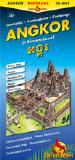
 Sample #1
 Sample #2
 Sample #3
 Sample #4
 Sample #5
 Sample #6
 Sample #7
 Sample #8
 Sample of the panoramic map
 Sample #1 of the main topographic map
 Sample #2 of the main topographic map
 Sample of the inset city map
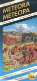 Limited stock!
 Sample of the panoramic map
 Sample of the inset maps
 Shows area covered by the map
 Sample #1
 Sample #2
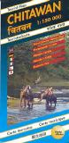
 Sample #1 of the main map
 Sample #2 of the main map
 Sample of an inset city map
 Sample from the panoramic map
 Sample of the main map
 Sample of the panoramic map
 Sample of the climbing routes map
 Sample #1 of the main map
 Sample #2 of the main map
 Sample #3 of the main map
 Sample of the Darchen city map
 Image of the entire map
 Sample #1 of the map detail
 Sample #2 of the map detail
 Sample #3 of the map detail
 Sample from the main road map.
 Sample from the Pokhara Valley map.
 Sample from the main Lhasa map
 Sample from the Potala Palace inset map
 Sample from the Norbulinka Summer Palace inset map
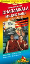
 Sample #1
 Sample #2
 Sample from the 1:750,000 road map.
 Sample from the Vang Vieng area 1:150,000 inset road map.
 Sample from the Vientiane 1:12,000 city center inset map.
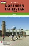
 Index map showing the coverage of the 3 sheets.
 Sample #1 from the Northern Tajikistan map
 Sample #2 from the Northern Tajikistan map
 Sample #3 from the Northern Tajikistan map
 Sample #4 from the Northern Tajikistan map
 Sample of the Khujand city map from the Northern Tajikistan map
 Sample #1 from the Southern Tajikistan map
 Sample #2 from the Southern Tajikistan map
 Sample #3 from the Southern Tajikistan map
 Sample of the Dushanbe city map from the Southern Tajikistan map
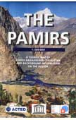
 Sample #1
 Sample #2