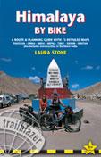
Himalaya by Bike - A Route & Planning Guide with 73 Detailed Maps for Pakistan - China - India - Nepal - Tibet - Sikkim - Bhutan. Trailblazer Guides. The Himalaya: the ultimate challenge for any adventurous cyclist. Not just the tallest mountains but also the highest roads in the world, passes of over 5300 meters, climbs over 50 kms and a 4500 meter descent. This guide covers the classic routes; Karakoram Highway, Leh-Srinagar, Bhutan, Sikkim, Friendship Highway, and many more. Pre-trip planning and advice on bikes, visas and permits, costs and money, and more. Route descriptions include hand-drawn maps with GPS waypoints, elevation profiles, etc. Town guides give advice on places to sleep and eat in the major cities such as Srinagar, Shimla, Darjeeling, etc. Paperback, 368 pages, 73 maps, 80 photos. Some of the maps recommended by the author are also listed below.
$29.95
65-7595HI
Guide
Recommended Maps
$14.99
65-4372
Himalaya & Tibet Map, with Bhutan, Ladakh, and Sikkim. 1:1,600,000. Gecko Maps.
$39.99
64-76741>
Sikkim Himalaya. 1:150,000. Swiss Foundation for Alpine Research. A black/white map.
Biking Map - 1000 Kilometers from Lhasa to Kathmandu. 1:400,000. Himalaya Map House/Nepa.
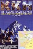
Recommended Karakoram Highway Friendship Map. 1:1,000,000. Callanan.
One thing that has always been lacking is a detailed map to this historic route. John Callanan has now filled that gap with this beautifully produced map, which incorporates town plans on the reverse. He has travelled the route seven times in total, and the result is an informative product, indispensable for anyone who has, or wishes to, journey along the highway.
Sample of the road map Sample of one of the city inset maps


 Recommended
 Sample of the road map
 Sample of one of the city inset maps