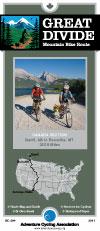
Great Divide Mountain Bike Route. Adventure Cycling Association. 2,470 miles -- The world's longest mountain bike
route; traces the Continental Divide from Canada to Mexico. The route runs from Roosville, Montana to
Antelope Wells, New Mexico, and includes six sections of map.
Route map.
62-2230-GD
Banff, Alberta to Antelope Wells, NM. Set of 7 maps. 10% discount!
$105.52
62-2230-GD7
Banff, Alberta to Roosville, MT.
$16.75
62-2230-GD1
Roosville, MT, to Polaris, MT.
$16.75
62-2230-GD2
Polaris, MT, to South Pass City, WY.
$16.75
62-2230-GD3
South Pass City, WY, to Silverthorne, CO.
$16.75
62-2230-GD4
Silverthorne, CO, to Platoro, CO.
$16.75
62-2230-GD5
Platoro, CO, to Pie Town, NM.
$16.75
62-2230-GD6
Pie Town, NM, to Antelope Wells, NM.
$16.75
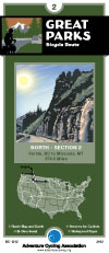
Great Parks Route
Great Parks Route. Adventure Cycling Association. 2,455 miles The jewels of the US park system (Rocky Mountain, Yellowstone, Teton, Glacier and Grand Canyon national parks) are linked with the gems of the
Canadian park system (Waterton, Kootenay, Banff, and Jasper national parks) on the Great Parks Route. Challenge the Rockies on this incredible route through the most scenic landscape in North America.
Great Parks Route Sketch map. Grand Canyon Connector sketch map.
62-2230-GP
Jasper, Alberta, to Durango, CO. Set of 8 maps listed below. 10% discount!
$120.60
62-2230-GP1
Jasper, Alberta, to Fernie, BC
$16.75
62-2230-GP2
Fernie, BC to Missoula, MT
$16.75
62-2230-TA04
Missoula, MT, to West Yellowstone, MT (same map as Trans America #4)
$16.75
62-2230-TA05
West Yellowstone to Rawlins (same map as Trans America #5)
$16.75
62-2230-TA06
Rawlins, WY, to Pueblo, CO (same as Trans America #6)
$16.75
62-2230-GPS1
Steamboat Springs, CO, to Poncha Springs, CO
$16.75
62-2230-GPS2
Poncha Springs, CO, to Durango, CO
$16.75
62-2230-GCC
Grand Canyon Connector. A beautiful side trip from Zion NP to the Grand Canyon NP
$16.75
Lewis & Clark Trail Route
Lewis & Clark Bicycle Trail. Adventure Cycling Association. 4,618 miles. Since 1998, Adventure Cycling Association has been compiling a new and ambitious set of bicycling maps following the route of Lewis and Clark. The Lewis & Clark Bicycle Trail was born of a desire to offer bicyclists a way to celebrate the bicentennial anniversary of the Corps of Discovery's journey, which began in 1804.
The Lewis & Clark Bicycle Trail's 4,618 miles cross nine mountain passes, pass through four national parks and monuments, overlook dozens of rivers in addition to the Missouri and the Columbia, and promise you views of bison, elk, deer, antelope and other wildlife. The Trail will be the best possible way to experience the magnificent landscapes witnessed by Lewis and Clark: all of the sense of wonder, all of the adventure, but a lot less inconvenience and hardship.
Our main 1804 westward route of Lewis and Clark is 3,254 miles in length, but overall the maps will cover 4,618 miles. The maps have been divided into eight sections covering both the westbound and eastbound routes taken by the Corps. There will be some mountain biking options available. Services are sometimes few and far between, making this one of our most challenging routes.
Route map.
62-2230-LCS
Hanford, IL to Astoria, OR & back. Set of 8 maps. 10% discount!
$120.60
62-2230-LC1
Hartford, IL to Council Bluffs, IA (555 miles).
$16.75
62-2230-LC2
Council Bluffs, IA to Pierre, SD (485.5 miles).
$16.75
62-2230-LC3
Pierre, SD to Williston, ND (510.5 miles).
$16.75
62-2230-LC4
Williston, ND to Great Falls, MT (538.5 miles).
$16.75
62-2230-LC5
Great Falls, MT to Missoula, MT (479.5 miles).
$16.75
62-2230-LC6
Missoula, MT to Clarkston, WA (242.5 miles), Lolo Trail (145.3 miles), Blackfoot Option (187.5 miles).
$16.75
62-2230-LC7
Clarkston, WA to Astoria, OR (442.5 miles).
$16.75
62-2230-LC8
Three Forks, MT to Williston, ND (506 miles).
$16.75
Northern Tier Route
Northern Tier Route Series. Adventure Cycling Association. 4,315 miles -- From the Puget Sound to fishing villages in Maine, the Northern Tier crosses three mountain ranges - the Cascades, Rockies and
Adirondacks. Along the way the route passes through Glacier National Park, the headwaters of the Mississippi and Amish country. Discover the beauty of America by crossing the country on the Northern Tier.
Route map.
62-2230-NT
Anacortes, WA, to Bar Harbor, ME. Set of 11 maps. 10% discount!
 Route map.
 Great Parks Route Sketch map.
 Grand Canyon Connector sketch map.
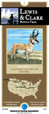
 Route map.
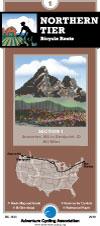
 Route map.