Germany Bicycle Touring Route Maps. 1:150,000. Allgemeiner Deutscher Fahrrad-Club. These are the official maps of the Allgemeinen Deutschen Fahrrad-Club e.V., the Germany cycling federation. The maps have contours at different intervals depending on the terrain, with steep roads also indicated by gradient marking. An overprint highlights national and local cycling routes and indicates various facilities, such as railway stations with bike rentals, cycle repair shops, campsites, youth hostels and shelters. Each map covers approximately 156 x 138 km (97 x 86 miles).
This series is in the process of being updated - all titles are expected to be fully revised by mid-2007. The new editions are better cartography that is easier to read and a UTM grid has been added. Unfortunately the maps/legends are still in German only. Each new edition map comes with a booklet of cycling/tourist information and Bett & Bike accommodation suggestions.
Sample of a map Index showing sheet coverage
$15.99
65-5460-01
Sheet 1: Mordfriesland/Schleswig.
$15.99
65-5460-02
Sheet 2: Holstein/Hamburg.
$15.99
65-5460-03
Sheet 3: Ostseeküste/Mecklenberg.
$15.99
65-5460-04
Sheet 4: Rügen/Vorpommern.
$15.99
65-5460-05
Sheet 5: Ostfriesland/Emsland.
$15.99
65-5460-06
Sheet 6: Zwischen Elbe und Weser.
$15.99
65-5460-07
Sheet 7: Lüneburger Heide/Hannover.
$15.99
65-5460-08
Sheet 8: Havelland/Magdeburger Börder.
$15.99
65-5460-09
Sheet 9: Brandenburg/Spreewald.
$15.99
65-5460-10
Sheet 10: Münsterland/Niederrhein.
$15.99
65-5460-11
Sheet 11: Ostwesrfalen/Sauerland.
$15.99
65-5460-12
Sheet 12: Harz/Leinetal.
$15.99
65-5460-13
Sheet 13: Sachsen/Westl. Erzgebirge.
$15.99
65-5460-14
Sheet 14: Lausitz/östl. Erzgebirge.
$15.99
65-5460-15
Sheet 15: Rheinland/Eifel.
$15.99
65-5460-16
Sheet 16: Rhein/Main/Nordhessen.
$15.99
65-5460-17
Sheet 17: Thüringer Wald/Rhön.
$15.99
65-5460-18
Sheet 18: Oberfranken/Vogtland.
$15.99
65-5460-19
Sheet 19: Mosel/Saarland.
$15.99
65-5460-20
Sheet 20: Rhein/Neckar.
$15.99
65-5460-21
Sheet 21: Mainfranken/Taubertal.
$15.99
65-5460-22
Sheet 22: Fränkische Alb/Altmühl.
$15.99
65-5460-23
Sheet 23: Bayerischer Wald/Donau.
$15.99
65-5460-24
Sheet 24: Schwarzwald/Oberrhein.
$15.99
65-5460-25
Sheet 25: Bodensee/Schwäbische Alb.
$15.99
65-5460-26
Sheet 26: Oberbayern/München.
$15.99
65-5460-27
Sheet 27: Ohiemsee/Inn Salzkammergut.
Germany Cycling Guides
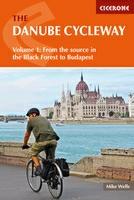
The Danube Cycle Way Guide. Cicerone, UK. The first in a two-volume set, this guidebook describes cycling the first 1271km of the Danube river from its source in the Black Forest to Budapest, passing through Germany, Austria, Slovakia and Hungary. Suitable for all levels of cyclist, the route visits the great cities of Vienna and Bratislava before arriving in the Hungarian capital.
NOTE: Volume 2, covering from Budapest to the Black Sea will be coming out later this year.
$24.95
64-74981DA-1
Guide, Vol. 1 - Danube Source to Budapest.
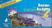
Now in English! Danube Cycling Guides. Bikeline. Follow the famous bike route along the Danube River. Volume 1 covers from Donaueschingen to Passau. Volume 2 covers the Austrian portion of the route - the most popular secion. Volume 3 covers the central-eastern portion of the route from Vienna to Budapest. Volume 4 covers from Budapest across Romania to Tulcea on the Black Sea coast. The guides contain detailed route maps and are highly recommended for cyclists, even though two of the guides are in German. The Cicerone guide above is the best descriptive guide of the route and is strongly recommended to accompany any of these four guides.
Index for Danube part #1 route. Index for Danube part #2 route. Index for Danube part #3 route. Map sample from vol. #1. Map sample from vol. #2. Map sample from vol. #3.
$19.99
66-2279-DA1
Danube Bike Trail Vol. 1 - Donaueschingen to Passau. 1:50,000 scale maps + 17 city maps, 152 pages.
$19.99
66-2279-DA2
Danube Cycling Guide (Vol. 2). 1:50,000 scale maps + city maps, 160 pages. Covers from Passau to Vienna. In English.
$19.99
66-2279-DA3
Danube Bike Trail Vol. 3 - Vienna to Budapest. 1:75,000 scale maps + 5 city maps, 132 pages.
Elbe River Guide, volume 2 - Magdeburg to Hamburg to Cuxhaven.
Europa Radweg Cycling Guide. 1:75,000. Bikeline. Covers from Arnheim to Berlin, crossing the Ems, Weser, Saale and Elbe rivers. Spiral-bound atlas, in German.
Index of the route. Sample of a map.
Iron Curtain Trail guide, vol. 1 - Barents Sea to the German-Polish border. 1:75,000 - 1:400,000. This first volume documents 3500 knm from the Norwegian Kikenes to the German-Polish border by Swinemuuml;nde.
$22.99
66-2279-IR2
Iron Curtain Trail guide, vol. 2 (German-German Border Trail) - Baltic Ocean to the Czech border. 1:75,000. 1400 kilometers in length. The present book describes the German-German Border Trail in the "Green Belt", which approaches 150 natural parks, 150 flora-and-fauna areas, three biosphere reservations Schaalsee, Elbaue and the Rhoen and the National Park of the Harz Mountains. It takes one from the Baltic to the Czech border, passes countless rivers, streams, and lakes and takes us through the higher parts of the Harz mountains and through the forests of Thuringia. We pass many monuments and border land museums and also several of the remaining observation towers. Of course there are many alternatives to taking this path. One can remain on the western or on the eastern side, one can stay close to the border or bike some distance from it, one can take the former control road with its perforated roadway or one can choose asphalt. The route in this book stays as close as possible to the former border, but stays on as comfortable a path as possible, avoids heavily travelled roads, integrates many historical monuments, crosses the former border at several points and informs about many monuments and museums.
$24.99
66-2279-IR3
Iron Curtain Trail guide, vol. 3 - German-Czech border to the Black Sea. 1:300,000. This guide covers the southern part of the trail, about 3300 km, from Hof at the German-Czech border to the Bulgarian-Turkish border by the Black Sea town of Carevo.
$19.99
66-2279-BER
Berlin Wall guide. 1:20,000. A route for cyclists, hikers and skaters along the path of the former Berlin Wall.
Rhein Radweg #1 - Andermatt to Lake Constance to Basel. 1:50,000. This guide covers the 435-km route along the Rhine from Andermatt to Lake Constance and on to Basel.
$19.99
66-2279-RR2
Rhein Radweg #2 - Basel to Mainz. 1:75,000. This guide covers the 815-km route along the Rhine from Basle to Mainz, between the Vosges mountains and the Black Forest.
$19.99
66-2279-RR3
Rhein Radweg #3 - Mainz to Duisburg. 1:75,000. This guide covers the 302-km long route along the Rhine River from Maiz, across the Rhine Gorge, to Koblenz, then on to Bonn, Cologne, Dusseldorf, and Duisburg.
$19.99
66-2279-RR4
Rhein Radweg #4 - Mainz to Rotterdam. 1:75,000. This guide covers the 442-km long route along the Rhine River from Duisburg to Rotterdam.
Cycling the Rhine Route. Cycle Publishing.
288 pages with 80 maps and 40 black & white photographs, paperback, 5½ x 8½ inches.
A spectacular tour from the sea to the mountains
Travel along many minor roads and paths away from traffic
Experience the cultural and historic diversity of much of Western Europe
Visit ports, castles, museums, ancient cities, and nature parks
Introductory chapters dealing with all relevant general information
For over 1,200 years, the Rhine river has been Europe's main corridor of transport, linking markets and cultures from the sea border in Holland with the inland regions all the way to Switzerland. Today's bicycle tourist can experience the great diversity of geography, architecture, trade, and culture that is still apparent along this spectacularly scenic waterway.
Best of all, it's not an exhausting ride: Despite the sometimes formidable mountains that look over the river, author John Powell has mapped out a route that keeps mainly level. The trip can be traversed all the way, requiring about three weeks of cycling, with all levels of accommodation readily available, or cut up into sections, with convenient points of access identified.
Altmühl River guide. 1:50,000. From Rothenburg to Kelheim, on the Danube. In German.
$19.99
66-2279-BER
Berlin Wall Trail. 1:20,000 scale maps, 140 pages. In English. A route for cyclists, hikers and skaters along the path of the former Berlin Wall.
$21.99
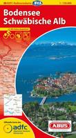
66-2279-BOD
Bodensee cycling atlas. 1:50,000. This atlas covers the entire route around the Bodensee (Lake Constance). In German.
$22.99
66-2279-DEU
Deutsch-Deutscher cycling atlas - Iron Curtain Trail. 1:75,000. This atlas covers the former Iron Curtain (East Germany - West Germany border) that divided the two Germanies. In German.
$25.99
65-5463-EL1
Elbe Radweg #1. 1:75,000 scale maps, 152 pages. In English. Bestseller! Covers the Elbe River from Magdeburg to Prague.
$24.99
65-5463-EL2
Elbe Radweg #2. 1:75,000 scale maps, 152 pages. In German. Bestseller! Covers the Elbe River from Cuxhaven through Hamburg to Magdeburg.
$17.99
66-2279-FU
Fulda River guide. 1:50,000. In German.
$19.99
64-1483-IN2
Inn Bike Trail: Vol. 2, Innsbruck to Passau (Inn Radweg 2). Covers the Inn River Trai from Innsbruck north to Passau in Germany. In German. ;
$20.95
66-2279-LAH
Lahntal Radweg cycling atlas. 1:50,000. This atlas cover the Lahn River from Bad Laasphe to Koblenz at the junction with the Rhein. In German.
$22.99
66-2279-MAI
Main Radweg guide. 1:75,000. A relaxing tour along the Main River from Mainz through Frankfurt, Würzberg, and Bamberg, then on to Bayreuth. In German.
$23.99
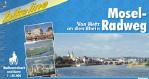
66-2279-MOS
Moselle River Trail. 1:50,000 scale maps + city maps, 120 pages. In English! This guide covers the 304-km route along the Moselle from Metz to the old Roman city of Trier, then across the southern Eifel to the Rhine. Two additional excursions from the main route go to Luxembourg and along the Ruwer valley. Accommodation suggestions included.
$20.95
66-2279-NAH
Nahe Radweg cycling atlas. 1:50,000. This atlas covers the Nahe from Birkenfeld to Bingen at the junction with the Rhein. In German.
$21.99
66-2279-NEC
Neckar Radweg cycling atlas. 1:50,000. Covers the Neckar River from Schwenningen through Stuttgart, to the Rhein at Mannheim. In German.
$18.95
66-2279-SAA
VeloTour SaarLorLux guide. 1:75,000. This guide covers the wonderful SaarLorLux area of western Germany; specifically Saarbrücken-Trier-Luxembourg-Metz. In German.
$15.95
66-2279-TBA
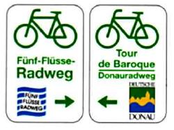
The Baroque Tour guide (Tour de Baroque). 1:50,000. From Newmarkt on the Altmühl to Passau on the Danube. In German.
$25.95
66-2279-VOR
Vorarlberg Cycling Atlas (Radatlas Vorarlberg). 1:60,000. A beautiful ride along the Rhein River from Lindau to Chur in Switzerland. In German. ;
 Sample of a map
 Index showing sheet coverage


 Now in English!
 Index for Danube part #1 route.
 Index for Danube part #2 route.
 Index for Danube part #3 route.
 Map sample from vol. #1.
 Map sample from vol. #2.
 Map sample from vol. #3.
 In English!
 Index showing the area covered by the Prague to Magdeburg guide.
 Index showing the area covered by the Magdeburg to Cuxhaven guide.
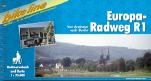
 Index of the route.
 Sample of a map.
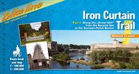 In English!
 Sketch map of the route covered by the Iron Trail guide volume 1
 Sketch map of the route covered by the Iron Trail guide volume 2 (German-German Trail)
 Sketch map of the route covered by the Iron Trail guide volume 3
 Sample detail from the Iron Curtain Trail cycling guide.
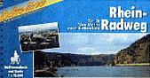
 Sample of a map from the Rhein Radweg volume 2.
 Sketch map showing coverage of volume 1 Andermatt to Basel.
 Sketch map showing coverage of volume 2 Basel to Mainz.
 Sketch map showing coverage of volume 3 Mainz to Duisburg.
 Sketch map showing coverage of volume 4 Duisburg to Rotterdam.
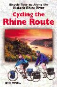
 Index map showing coverage of the Bikeline guides for Germany.
 Sample of a map from the Moselle volume.
 Sample of a route map from the Bodensee guide.
 Sample of a page of text and inset city map from the Bodensee guide.
 Sample of a route map from the Neckar guide.
 Sample of a page of text and inset city map from the Neckar guide.
 Sample of a city route map from the Fulda River guide
 Sample of a text page from the Fulda River guide
 Sample page from the Weser River guide


