Bella Terra's state & regional lighthouse maps are a unique combination of map, guidebook & souvenir. Each title is available as a folded map or laminated poster.
The cartography makes it easy to spot lighthouse locations. And the guides take you right there, with well-researched histories and viewing directions.
Beautiful, original watercolor illustrations make these maps delightful keepsakes.
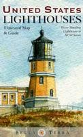
United States Lighthouses Map. Bella Terra, 2011. Map size, unfolded/flat, is 39 x 27 inches.
The most up-to-date and comprehensive U.S. lighthouse directory.
All 770 standing lighthouses in the 50 states located on detailed regional maps--including Lake Havasu, AZ/CA.
Each official lighthouse name, alternate names, year of first lighting, year of current structure, physical location & latitude/longitude.
Recommended! Florida Lighthouses Map. Bella Terra Publishing.
The illustrated map and guide to all Florida lighthouses. All standing and "lost" lighthouses in Florida are located on a detailed state map. History and description of each lighthouse. Directions to each light or best viewing spots. 33 original watercolor illustrations. Directory of lighthouse cruises, sightseeing flights and island ferries. Lighthouse and maritime museums listed and located on map. True tales of Florida lighthouses. Paper, 36" x 24", folded to 4" x 9", printed two sides.
Image of the entire Florida Lighthouses map. Sample detail from the Florida Lighthouses map.
62-61917
1 sheet, folded.
$6.95
62-61917L
1 sheet, laminated.
$12.95
Maine Lighthouses Map. Bella Terra Publishing. The illustrated map and guide to ALL Maine lighthouses features:
Detailed shaded relief map of the Maine coast
37 original watercolor illustrations
Locations of all standing and "lost" lighthouses in Maine, plus coastal New Hampshire & nearby New Brunswick
History & description of each lighthouse
Directions to view each standing light
Locations & directory of Lighthouse & Maritime Museums
Northwest Lighthouses Illustrated Map & Guide - Oregon, Washington, Alaska. Bella Terra, 2010. 24 x 36" flat, 4 x 9" folded. Available folded or laminated. ISBN 9781888216363.
Image of the front of the map.
Detailed shaded relief maps, including Inside Passage inset
Locations of all standing & "lost" lighthouses in Oregon, Washington & Alaska
31 original watercolor illustrations
History & description of each lighthouse
Detailed directions to view each standing light
Locations & directory of Lighthouse & Maritime Museums
Lighthouses of the Southeast Map. Bella Terra Publishing, June 2010. Size is 36 x 24 inches.
The illustrated map and guide to ALL the lighthouses of North Carolina, South Carolina and Georgia features:
Detailed shaded relief map of the coast, plus insets of Wilmington, Charleston and Savannah
24 original watercolor illustrations
Locations of all standing & "lost" lighthouses in the three states
History & description of each lighthouse
Directions to view each standing light
Locations & directory of Lighthouse & Maritime Museums
Directory of Lighthouse Cruises, Sightseeing Flights & Island Ferries
 Sample detail of the USA Lighthouses Map

 Front of the California lighthouse map
 Reverse of the California lighthouse map
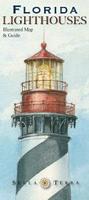 Recommended!
 Image of the entire Florida Lighthouses map.
 Sample detail from the Florida Lighthouses map.
 Image of the entire Maine Lighthouses map.
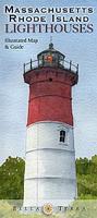
 Image of the entire Massachusetts Lighthouses map.
 Image of the entire Mid-Atlantic Lighthouses map.
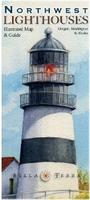
 Image of the front of the map.
 Lighthouses of the Southeast Map. Bella Terra Publishing, June 2010. Size is 36 x 24 inches.
 Image of the entire Lighthouses of the Southeast map.