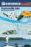
Navionics Fishing Maps. Using advanced computerized hydrographic survey technology, Navionics collected thousands of man-hours of data including water depth, lake bottom characteristics, sonar imagery and global positioning points for selected lakes across the country. The data, ranging from several hundred thousand to several million data points per map, is edited to create highly detailed lake bottom fishing maps.
Features of the lake maps.
Color shaded depth contours.
Major routes and highways.
Double-sided with detailed area insets.
Area points-of-interest.
Top-down satellite photo overlay.
Tear resistant.
3D lake overview.
Water resistant or water proof.
Measures approximately 24" x 36" - folds to small booklet size.
Most popular lakes have multiple sheets for the most detailed coverage.
$19.99
63-01932-BU
Butte des Morts, Poygan, & Winnicone fishing map.
$19.99
63-01932-CA
Castle Rock Lake fishing map.
$19.99
63-01932-MI
Mississippi River Lock #9 fishing map.
$19.99
62-67932-MI
(IA/WI) Mississippi River Lock 10 fishing map.
Wisconsin's Rivers Fishing Maps by Wilderness Adventures Press. An essential tool for a successful fly-fishing trip is a detailed map of the water. One that will give you the access points, boat launches, campgrounds, public areas, roads, and GPS coordinates to pinpoint your location.
These maps are ideal for planning your trip - where to access the river, where to camp, etc. They are not designed to show every little eddy and pool; they are too small scale for that.
Bois Brule River fishing map. The Bois Brule River from headwaters near Solon Springs, WI, to Lake Superior.
$9.95
63-01934-MEN
Menominee River fishing map. Menominee River from Little Quinnesec Falls to Lake Michigan.
$9.95
63-01934-MIL
Milwaukee River fishing map. Milwaukee River from West Bend to Lake Michigan.
$9.95
63-01934-WIS
Wisconsin River fishing map. Wisconsin River from Eagle River to Lake Wausau.
Wisconsin Fishing Maps by Fishing Hot Spots
Wisconsin Fishing Maps by Fishing Hot Spots are superb maps showing the lake bottoms for hundreds of lakes and rivers across the USA. These maps are printed on either kimdura or Hop-syn (both tear-resistent waterproof synthetic materials), making them nearly indestructible. The maps show lake bottom contours, shoreline features, roads leading to the lakes, boating facilities along the lake shore, and much more.
Fishing Map sample Enlargement
$14.95
62-9593-L721
Lake Amistad fishing map. L721.
$9.95
63-0193-G134
Lake Arbutus (Jackson Co.) fishing map.
$9.95
63-0193-G272
Beulah Lake (Walworth Co.) fishing map.
$14.95
63-0193-G104
Big & Little Arbor Vitae Lake fishing map.
$9.95
63-0193-G233
Big Cedar Lake (Washington Co.) fishing map.
$9.95
63-0193-G205
Big Crawling Stone Lake fishing map.
$9.95
63-0193-G105
Big Muskellunge Lake (Vilas Co.) fishing map.
$9.95
63-0193-G279
Big Sand Lake (Vilas Co.) fishing map.
$7.99
63-0193-G177
Big Sissabagama (Sawyer Co.) fishing map.
$14.95
63-0193-G106
Big & Little St. Germain Lake fishing map.
$9.95
63-0193-G271
Blackhawk Lake fishing map.
$9.95
63-0193-G245
Bone Lake (Polk Co.) fishing map.
$14.95
63-0193-G263
Boom Lake-Rhinelander Flowage fishing map.
$9.95
63-0193-G273
Browns Lake (Racine Co.) fishing map.
$9.95
63-0193-G241
Buckatabon Lakes-Upper & Lower fishing map.
$7.99
63-0193-G108
Buckskin Lake (Oneida Co.) fishing map.
$9.95
63-0193-G239
Buffalo Lake (Marquette Co.) fishing map.
$9.95
63-0193-G232
Butternut Lake (Forest Co.) fishing map.
$9.95
63-0193-G216
Butternut Lake (Price Co.) fishing map.
$14.95
63-0193-M135
Caldron Falls Flowage fishing map.
$9.95
63-0193-G109
Carrol Lake (Oneida Co.) fishing map.
$14.95
63-0193-L246
Castle Rock Flowage fishing map.
$7.99
63-0193-G227
Chain/Clear Lakes (Rusk Co.) fishing map.
$14.95
63-0193-L236
Chequamegon Bay-Lake Superior fishing map.
$9.95
63-0193-G246
Chequamegon Waters (Miller Dam Flowage) fishing map.
$14.95
63-0193-G228
Lake Chetac & Birch Lake (Sawyer Co.) fishing map.
$14.95
63-0193-M157
Chetek Chain (Barron Co.) fishing map.
$14.95
63-0193-L238
Chippewa Flowage fishing map.
$9.95
63-0193-G149
Crescent Lake (Oneida Co.) fishing map.
$14.95
63-0193-L767
Dairyland Flowage fishing map.
$9.95
63-0193-G110
Dam Lake (Oneida Co.) fishing map.
$9.95
63-0193-G247
Deer Lake (Polk Co.) fishing map.
$14.95
63-0193-M370
Lake Delavan fishing map. Out of print and only available while supplies last.
$14.95
63-0193-M372
Lake DuBay fishing map.
$14.95
63-0193-L239
Eagle River Chain (Vilas Co.) fishing map.
$9.95
63-0193-G200
Fence Lake fishing map.
$9.95
63-0193-G243
Flambeau Lake (Vilas Co.) fishing map.
$9.95
63-0193-G224
Fox Lake (Dodge Co.) fishing map.
$9.95
63-0193-G242
Franklin Lake (Forest Co.) fishing map.
$14.95
63-0193-L241
Lake Geneva fishing map.
$9.95
63-0193-G111
Gile Flowage fishing map.
$7.99
63-0193-G112
Gilmore Lake (Oneida Co.) fishing map.
$14.95
63-0193-L237
Green Bay (Includes Fox River at DePere) fishing map.
$14.95
63-0193-M137
High Falls Flowage fishing map.
$14.95
63-0193-M174
Holcombe Flowage (Chippewa Co.) fishing map.
$9.95
63-0193-G262
Island/McCann Lakes (Rusk Co.) fishing map.
$9.95
63-0193-G116
Katherine Lake fishing map.
$9.95
63-0193-G225
Kentuck Lake fishing map.
$14.95
63-0193-M105
Lake Koshkonong / Rock River fishing map.
$14.95
63-0193-M177
Lac Courte Oreilles & Grindstone Lake (Sawyer Co.) fishing map.
$14.95
63-0193-M142
Lac Vieux Desert (WI/MI) fishing map.
$9.95
63-0193-G136
Little Green Lake fishing map.
$9.95
63-0193-G276
Little Muskego Lake fishing map.
$9.95
63-0193-G265
Long Lake (Fond du Lac Co.) fishing map.
$14.95
63-0193-M178
Long Lake (Washburn Co.) fishing map.
$9.95
63-0193-G119
Lost Lake (Vilas Co.) fishing map.
$9.95
63-0193-G199
Lost Land Lake (Sawyer Co.) fishing map.
$9.95
63-0193-G251
Marshmiller Lake (Chippewa Co.) fishing map.
$14.95
63-0193-M106
Lake Mendota fishing map.
$9.95
63-0193-G240
Lake Menomin (Dunn Co.) fishing map.
$9.95
63-0193-G266
Lake Metonga fishing map.
$7.99
63-0193-G248
Middle Eau Claire Lake (Bayfield Co.) fishing map.
$14.95
63-0193-L245
Minocqua/Kawaguesaga/Mid Lakes fishing map.
$9.95
63-0193-G226
Minong Flowage fishing map.
$14.95
62-7593-M245
Mississippi River - Pool 4 (Includes Lake Pepin) fishing map.


 Front of the Bois Brule River fishing map
 Sample detail from the front of a river map from this series (Deschutes River)
 Sample detail from the back of a river map from this series (Truckee River)
 Sample detail #2 from the back of a river map from this series (Metolius River)
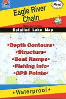 Wisconsin Fishing Maps by Fishing Hot Spots are superb maps showing the lake bottoms for hundreds of lakes and rivers across the USA. These maps are printed on either kimdura or Hop-syn (both tear-resistent waterproof synthetic materials), making them nearly indestructible. The maps show lake bottom contours, shoreline features, roads leading to the lakes, boating facilities along the lake shore, and much more.
 Fishing Map sample
 Enlargement