Vermont Fishing Maps by Fishing Hot Spots are superb maps showing the lake bottoms for hundreds of lakes and rivers across the USA. These maps are printed on either kimdura or Hop-syn (both tear-resistent waterproof synthetic materials), making them nearly indestructible. The maps show lake bottom contours, shoreline features, roads leading to the lakes, boating facilities along the lake shore, and much more.
Fishing Map sample Enlargement
$14.95
62-8493-S456
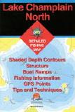
Lake Champlain-North (Missisquoi Bay-Plattsburgh)fishing map(NY/VT).
$14.95
62-8493-S457
Lake Champlain-Central (Plattsburgh-Split Rock Point)(NY/VT) fishing map.
$14.95
62-8493-S458
Lake Champlain-South (Split Rock Point-Whitehall)(NY/VT) fishing map.
 Fishing Map sample
 Enlargement