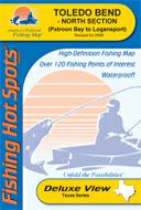
Texas Fishing Maps by Fishing Hot Spots are superb maps showing the lake bottoms for hundreds of lakes and rivers across the USA. These maps are printed on either kimdura or Hop-syn (both tear-resistent waterproof synthetic materials), making them nearly indestructible. The maps show lake bottom contours, shoreline features, roads leading to the lakes, boating facilities along the lake shore, and much more.
Fishing Map sample Enlargement
$14.95
62-9593-L721
Lake Amistad fishing map.
$14.95
62-9593-L716
Lake Belton fishing map.
$14.95
62-9593-L720
Lake Bob Sandlin, Monticello & Cypress Springs fishing map.
$14.95
62-9593-L711
Lake Buchanan & Inks Lake fishing map. Out of print and only available while supplies last.
$14.95
62-9593-L719
Caddo Lake fishing map.
$14.95
62-9593-L718
Canyon Lake fishing map.
$14.95
62-9593-A419
Cedar Creek Lake fishing map.
$14.95
62-9593-A420
Choke Canyon Lake fishing map.
$14.95
62-9593-A421
Lake Conroe fishing map.
$14.95
62-9593-L709
Eagle Mountain fishing map.
$14.95
62-9593-A439
Fayette County Lake fishing map.
$14.95
62-9593-A422
Lake Fork Reservoir fishing map.
$14.95
62-9593-L722
Grapevine Lake fishing map.
$14.95
62-9593-A440
Lake Houston fishing map.
$14.95
62-9593-L723
Lavon Lake fishing map.
$14.95
62-9593-L725
Lewisville Lake fishing map.
$14.95
62-9593-A427
Lake Livingston fishing map.
$14.95
62-9593-L712
Lyndon B. Johnson & Marble Falls fishing map.
$14.95
62-9593-A424
Lake O' The Pines fishing map.
$14.95
62-9593-A429
O.H. Ivie Reservoir fishing map.
$14.95
62-9593-A430
Lake Palestine fishing map.
$14.95
62-9593-A432
Lake Ray Hubbard fishing map.
$14.95
62-9593-A433
Lake Ray Roberts fishing map.
$14.95
62-9593-A434
Richland-Chambers Lake fishing map.
$14.95
62-9593-A435
Lake Sam Rayburn fishing map.
$14.95
62-9593-L717
Stillhouse Hollow Lake fishing map.
$14.95
62-9593-L710
Lake Tawakoni fishing map.
$14.95
62-9593-A353
Lake Texoma fishing map.
$14.95
62-9593-A437
Toledo Bend Lake-North (Patroon Bay to Logansport) (TX/LA) fishing map.
$14.95
62-9593-A438
Toledo Bend Lake-South (Dam to Patroon Bay) (TX/LA) fishing map.
$14.95
62-9593-L713
Lake Travis fishing map.
$14.95
62-9593-L715
Lake Whitney fishing map.
$14.95
62-9593-L714
Wright Patman Lake fishing map.
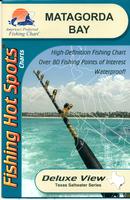
Texas Saltwater Fishing Maps by Fishing Hot Spots are superb maps showing the lake bottoms for hundreds of lakes and rivers across the USA. These maps are printed on either kimdura or Hop-syn (both tear-resistent waterproof synthetic materials), making them nearly indestructible. The maps show lake bottom contours, shoreline features, roads leading to the lakes, boating facilities along the lake shore, and much more.
Sample #1 from the Matagorda Bay map Sample #2 from the Matagorda Bay map Sketch map showing coverage of each Saltwater fishing map
$19.95
62-9593-TX0104
Baffin Bay fishing map.
$19.95
62-9593-TX0106
Corpus Christi Bay Fishing Map.
$19.95
62-9593-TX0115
East Galveston Bay Fishing Map.
$19.95
62-9593-TX0114
Galveston Bay Fishing Map.
$19.95
62-9593-TX0110
Matagorada Bay Fishing Map.
$19.95
62-9593-TX0107
Port Aransas Fishing Map.
$19.95
62-9593-TX0116
Sabine Lake Fishing Map.
$19.95
62-9593-TX0113
West Galveston Bay Fishing Map.
Navionics Fishing Maps. Using advanced computerized hydrographic survey technology, Navionics collected thousands of man-hours of data including water depth, lake bottom characteristics, sonar imagery and global positioning points for selected lakes across the country. The data, ranging from several hundred thousand to several million data points per map, is edited to create highly detailed lake bottom fishing maps.
Features of the lake maps.
Color shaded depth contours.
Major routes and highways.
Double-sided with detailed area insets.
Area points-of-interest.
Top-down satellite photo overlay.
Tear resistant.
3D lake overview.
Water resistant or water proof.
Measures approximately 24" x 36" - folds to small booklet size.
Most popular lakes have multiple sheets for the most detailed coverage.
Buy
Sample
Catalog #
Title
Price
62-95932-BU
(TX) Lake Buchanan fishing map.
$19.99
62-95932-CE
(TX) Cedar Creek Reservoir fishing map set. 2 sheets.
$29.99
62-95932-CH
(TX) Choke Canyon Reservoir fishing map.
$19.99
62-95932-CY
(TX) Lake Cypress Springs fishing map.
$19.99
62-95932-EA
(TX) Eagle Mountain Lake fishing map.
$19.99
62-95932-GR
(TX) Grapevine Lake & Lake Lewisville fishing map.
$19.99
62-95932-PO
(TX) Joe Pool fishing map.
$19.99
62-95932-SA
(TX) Lake Bob Sandlin & Lake Monticello fishing map.
$19.99
62-95932-TE
(TX) Lake Texoma fishing map set. 2 sheets.
$36.99
62-95932-TR
(TX) Lake Travis fishing map.
$19.99
Fish-N-Map Company underwater topography maps are printed on a waterproof, tear-resistant material and are folded to 9" x 4". When opened, each map is approximately
3' x 2' in size and is printed on both sides. These maps feature waterproof plastic "paper"; underwater depth contours; fish locations; latitude and longitude for GPS; often multiple lakes on one map; boat
ramps; recreational facilities; and much more.
Aransas Bay & San Antonio Bay (including Copano & Espiritu Santo Bays).
$16.95
62-9593-CQ
Corpus Christi Bay & Baffin Bay (including Upper Laguna Madre, Alazan Bay, Cayo del Grullo).
$16.95
62-9593-LF
Lake Fork, Lake Tawakoni. 5' contours.
$16.95
62-9593-GB
Galveston Bay saltwater map (Trinity Bay, East & West Bays to San Luis Pass). 1' contours.
$10.99
62-9593-GM
Gulf of Mexico East - Galveston Pass - Sabine Pass (San Luis Pass, Outer Banks). 5' contours.
$16.95
62-9593-GN
Gulf of Mexico West - Freeport & San Luis Pass to Mexico.
$18.95
62-9593-LJ
Lake Livingston. 5' contours.
$10.99
62-9593-MB
Matagorda Bay (includes East Matagorda Bay, Port O'Connor, Port Levaca). 5' contours.
$18.95
62-9593-RE
Redfish Bay (Aransas Pass, South Bay, Mud Island, Rockport, Shamrock Island, Fulton & Allyns Bight). 2' contours.
$16.95
62-9593-SC
Sabine Lake/Calcasieu Lake.
$18.95
62-9593-SB
Sam Rayburn Reservoir. 5' contours.
$16.95
62-9593-WE
(TX) West Bay - Galveston Jetties (San Luis Pass to Galveston Ship Channel). 1' contours.
Texas Fishing Maps by A.I.D. Assoc. Texas is the specialty of A.I.D., as shown by the selection of lake maps. These maps are well researched to show accurately underwater details, including ponds, creeks, ridges, valleys, trees, roads, and cemeteries. The maps are printed on waterproof synthetic material and have either a 60-second latitude/longitude grid or GPS coordinates for specific spots (docks, fishing spots, etc.).
Full-color photographs and information on the map tell you what resorts, marinas, motels, bait and tackle stores, restaurants, and other businesses in the area have to offer and how to phone ahead for reservations.
Unfortunately this publisher has retired/closed and we have limited stock left.
Sample #1. Sample from the Belton-Stillhouse, Texas map.
Sample #2. Sample from the Fayette County, Texas map.
Sample #3. Sample from the Conroe, Texas map.
Sample #4. Sample from the Red River, Louisiana map.
Sample #5. Sample from the Limestone/Fairfield, Texas map.
$12.99
62-95931-AM
Amistad fishing map. (with lat-long grid).
$12.99
62-95931-CY
Cypress Spring / Bob Sandlin / Monticello fishing map. (with lat-long grid).
$12.99
62-95931-EB
Eagle Mountain fishing map. (with lat-long grid).
$12.99
62-95931-FC
Falcon Lake and Choke Canyon fishing map. (with lat-long grid).
$12.99
62-95931-FD
Fayette County fishing map. (with GPS coordinates).
 Fishing Map sample
 Enlargement
 Texas Saltwater Fishing Maps by Fishing Hot Spots are superb maps showing the lake bottoms for hundreds of lakes and rivers across the USA. These maps are printed on either kimdura or Hop-syn (both tear-resistent waterproof synthetic materials), making them nearly indestructible. The maps show lake bottom contours, shoreline features, roads leading to the lakes, boating facilities along the lake shore, and much more.
 Sample #1 from the Matagorda Bay map
 Sample #2 from the Matagorda Bay map
 Sketch map showing coverage of each Saltwater fishing map


 A sample of a map legend.
 Sample #1.
 Sample #2.
 Sample #3.
 Sample #4.
 Sample #5.