Fish-N-Map Company underwater topography maps are printed on a
waterproof, tear-resistant material and are folded to 9" x 4". When opened, each map is approximately
3' x 2' in size and is printed on both sides. These maps feature waterproof plastic "paper"; underwater
depth contours; fish locations; latitude and longitude for GPS; often multiple lakes on one map; boat
ramps; recreational facilities; and much more.
Billy Chinook Lake & Lake Simtustus fishing map. 1:16,000. 20' depth contours. Lake Billy Chinook, formed in 1964 when the Round Butte Dam was constructed, is located in Oregon's The Cove Palisades State Park. Lake Billy Chinook has a surface area of 4,000 acres.
$18.95
62-6493-BR
(ID/OR) Brownlee Reservoir fishing map. 1:24,000. 20' depth contours. Brownlee Reservoir is located on the Idaho and Oregon border. Brownlee Reservoir is the uppermost reservoir of the Hells Canyon Complex on the Snake River.
$16.95
62-8993-CL
Columbia River, Lower (Bonneville Dam to the Pacific Ocean, including Portland). 5' contours.
$16.95
62-8993-CU
Columbia River, Upper (McNary Dam to Bonneville Dam; Lake Umatilla, the Dalles). 5' contours.
$16.95
62-8993-DF
Detroit Lake fishing map. 1:16,000. 10' depth contours. Detroit Lake was created in 1953 when the Army Corp. of Engineers completed the Detroit Dam project. Detroit Lake is part of the Oregon Parks and Recreation Department and is located in Oregon's Cascade Mountains.
$16.95
62-8993-WI
Willamette River fishing map. 1:30,000.
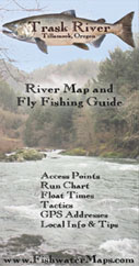
Kilchis River Fishing Map. Fishwater Maps by Chris Gibbs.
This map measures 11" x 17" and is printed on waterproof; heavy duty synthetic paper that can take years of abuse on the water. It has access points, hatch charts, GPS Points, water release travel times on tailwaters, float times for boaters, fly and tackle recommendations, important phone numbers and local information such as where to eat, where to sleep and other services of interest to fisherman.
Sample detail.
$10.99
62-89933-KIL
Lower Deschutes River map. Frank Amato Publications, 1998. Full color info-packed map for fly fishing the lower Deschutes River in OR. Tells which flies are most productive, what hatches & when, & much more. Gives info on access points, boat launches & campgrounds. Laminated.
$5.95
62-8993-DE
1 sheet, folded.
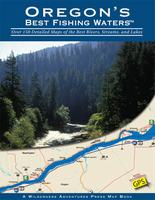
Oregon's Best Fishing Waters Atlas. Wilderness Adventures Press.
This is the most comprehensive angling map ever created for Oregon's rivers and streams. There are a total of 179 full color 8-1/2 x 11" detailed maps, each showing access sites, boat ramps, campgrounds, roads and trails. All access sites are clearly marked with GPS coordinates. River miles, public and private land, dams, rapids, and a wealth of other useful information for anglers is included. Thirty-three of Oregon's best waters are mapped, including the Deschutes, Elk, Fall, Grande Ronde, Hood, John Day, Klamath, McKenzie, Nehalem, Rogue, Sandy, Tillamook Bay, Chetco, Clackamas, Willamette, Umpqua, and others. Public land is clearly identified in color, and every possible access or state lease is easy to find with just a glance. Oregon's Best Fishing Waters is a must have for any avid fisherman.
Sample detail of an overview map from the Oregon fishing atlas. Sample detail of a river-section map from the Oregon fishing atlas.
$28.95
62-8993A
Atlas.
Complete Angler's Guide to Oregon. Wilderness Adventures Press.
Oregon is a fisherman's paradise, with blue-ribbon water spreading from the coastal steelhead rivers all the way to the lakes and streams in the eastern desert. This comprehensive, statewide guide written for bait, spin and fly fishers, provides accurate, highly detailed maps and descriptions of each water, along with hub city information that includes area restaurants, sporting good stores, motels, and more.
$29.95
62-8995CAO
Guide.
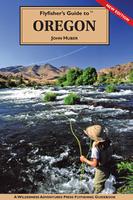
Flyfishers Guide to Oregon. Wilderness Adventures Press.
John Huber describes in detail the best fishing waters. John gives you tips on how and when to fish each water along with recommended flies. He also has hatch charts and stream facts for each water. All of the famous streams are covered, including the Grande Ronde, Klamath, Rogue, McKenzie, Willamette, Clackamus, Salmon, Hood, John Day, Deschutes and many others. John also covers many small stream gems and the lakes, such as Crane Prairie, Gold, Chickahominy, Klamath, Antelope Flat and more. There are over 77 detailed river maps, showing public access, roads, boat launches, campsites, and river miles. Each region has complete travel information and listings for fly shops, sporting good stores, guides, outfitters, lodges, motels, restaurants, campgrounds, and more.
$28.95
62-8995FGO
Guide.
Oregon River Fishing Maps by Wilderness Adventures Press. An essential tool for a successful fly-fishing trip is a detailed map of the water. One that will give you the access points, boat launches, campgrounds, public areas, roads, and GPS coordinates to pinpoint your location.

 A sample of a map legend.

 Sample detail.
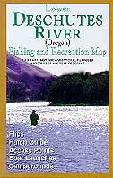
 Sample detail of an overview map from the Oregon fishing atlas.
 Sample detail of a river-section map from the Oregon fishing atlas.
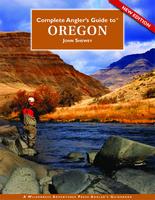 Complete Angler's Guide to Oregon. Wilderness Adventures Press.
 Flyfishers Guide to Oregon. Wilderness Adventures Press.
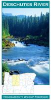
 Front of the Deschutes River fishing map
 Sample detail from the Deschutes River map
 Sample detail #1 from the back of a river map from this series (Truckee River)
 Sample detail #2 from the back of the Metolius River map