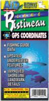
Louisiana Fishing Maps by A.I.D. Assoc. These maps are well researched to show accurately underwater details, including ponds, creeks, ridges, valleys, trees, roads, and cemeteries. The maps are printed on waterproof synthetic material and have a 60-second latitude/longitude grid.
Full-color photographs and information on the map tell you what resorts, marinas, motels, bait and tackle stores, restaurants, and other businesses in the area have to offer and how to phone ahead for reservations.
Sample #1. Sample from the Belton-Stillhouse, Texas map.
Sample #2. Sample from the Fayette County, Texas map.
Sample #3. Sample from the Conroe, Texas map.
Sample #4. Sample from the Red River, Louisiana map.
$12.99
62-95931-CB
Caddo fishing map. LA/TX.
$12.99
62-95931-TO
Toledo Bend fishing map. TX/LA.
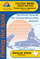
Louisiana Fishing Maps by Fishing Hot Spots are superb maps showing the lake bottoms for hundreds of lakes and rivers across the USA. These maps are printed on either kimdura or Hop-syn (both tear-resistent waterproof synthetic materials), making them nearly indestructible. The maps show lake bottom contours, shoreline features, roads leading to the lakes, boating facilities along the lake shore, and much more.
Fishing Map sample Enlargement
$14.95
62-9593-A437
Toledo Bend Lake-North (Patroon Bay to Logansport) (TX/LA) fishing map.
$14.95
62-9593-A438
Toledo Bend Lake-South (Dam to Patroon Bay) (TX/LA) fishing map.
 Sample #1.
 Sample #2.
 Sample #3.
 Sample #4.
 Louisiana Fishing Maps by Fishing Hot Spots are superb maps showing the lake bottoms for hundreds of lakes and rivers across the USA. These maps are printed on either kimdura or Hop-syn (both tear-resistent waterproof synthetic materials), making them nearly indestructible. The maps show lake bottom contours, shoreline features, roads leading to the lakes, boating facilities along the lake shore, and much more.
 Fishing Map sample
 Enlargement