|
|
(China) Atlas of Xinjiang Uygur Autonomous Region. 2004. In Chinese. Lots of physical maps at various scales. ISBN 7-5031-3550-6. Hardbound 8 ½ x 12". 307 pages.
(China) China Railway Atlas. 2004. In Chinese. Railways shown province by province. Scales vary. Hardbound 10 ½ x 15". 139 pages.
(China) Climatological Atlas of the People's Republic of China. 1:17,000,000 & 1:12,000,000. 2002. China Meteorological Press. Bilingual Chinese/English. There are over 100 pages of maps illustrating 30 years (1961-1990) of meteorological data. Data include air temperature, precipitation, sunshine, humidity, cloud cover, wind and ground temperature. Hardbound 11 x 16". ISBN 7-5029-3380-8. 250 pages.
El Salvador Atlas (Atlas de El Salvador). 1:500,000. Ministry of Economy, National Center of Registries & IGN, 2000. 4th edition. Basic atlas includes 25 thematic maps and text in Spanish covering economy, culture, geology, geography, soils, climate
Paperback 13½ x 23". 66 pages.
64-5246 (vendored)
Atlas of Thailand. Spatial Structures and Development. IRD, 2004. English version published by Silkworm Books. Very detailed socio-economic atlas divided into nine chapters: Situations of the Territory, Population, The state of the construction of the country, Agriculture, Industry, Tertiary section, Bangkok and metro area, Two peripheral regions, Social imbalances and Spatial Organization. ISBN 974-9575-43-1. Paperback 8½ x 12". 209 pages.
65-4247 (vendored)
Austria Satellite Photo Atlas (Osterriech Satelliten Bildatlas). 1:200,000. Geospace Verlag, 2004. Topographic atlas. Each map has the corresponding satellite image. Larger scales over the cities. The quality of the images and maps is excellent. Hardbound, 10 x 14".
64-1447
Map of Potential Natural Vegetation of the Czech Republic. 1:500,000. Academia Prague, 2001. ISBN 80-200-0687-7. Map and 341 page text, Bilingual.
64-4633
Armenia Raised Relief. 1:1,250,000. 11 x 13".
65-6288 (vendored)
Atlas of Antarctica Topographic Maps from Geostatistical Analysis of Satellite Radar Altimeter Data. Springer, 2004. Text is accentuated by lots of black/white maps and charts. Includes CD-ROM with ASCII data. ISBN 3-540-43457-7. Hardbound 9 x 12". $165.
66-19493 Text, 364pp. (vendored)
Historic Atlas of Italian Resistance (Atlante Storico della Resistenza Italiana). Paravia Bruno Mondadori Editori, 2000. Instituto Nacionale per la Storia del Movimento di Liberazione in Italia. Hardcover 10 ¾ x 14¼" 159 pages.
64-8244
Brazil Atlas (Atlas du Brésil Hervé Théry Neli Aparecida de Mello). CNRS, Libergéo - La Docomentation Francaise, 2003. ISBN 2-11-005563-4. Paperback 8 ¼ x 10". 302 pages.
64-2445 (vendored)
Croatia Historical Atlas (Hrvatski Povijesni Atlas). Leksikografski Zavod Miroslav Krleza, 2003. Text in Croatian. Well-made, attractive maps. ISBN 953-6036-02-9. Hardbound 7 x 10". 386 pages.
65-6946 (vendored - check correct vendor)
Guinée Morphology and Soils (Guinée Carte Morphopédologique). 1:500,000. IRD Editions, 2003. 2-sheet map and text with three appendixes by Yves Boulvert. ISBN of texts: 2-7099-1536-7. Text: Carte Morphoped. Annexe 1: Extractions Cartographiques et Photographies. Annexe 2: Elements du climat Guinée et Péri-Guinéen. Annexe 3: Documents Phytogéographiques.
64-6935 (vendored)
Admap - Magnetic Anomaly Map of the Antarctic. 1:10,000,000. British Antarctic Survey, 2001. Sheet No. BAS (Misc) 10. 38 x 29".
66-1914 (vendored)
Austria Digital Climate Atlas (ÖKLIM Digitaler Klimaatlas Österreichs). Intermedias, Zentralanstalt für Meteorologie und Geodynamik Wien, 2001. CD-ROM.
64-1431 (vendored)
|


 Sample detail of the Savannah street map
 Sample detail of the Charleston street map
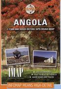
 Sample detail of the Angola Touring Map
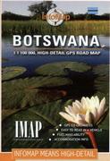
 Sample detail of the Botswana Touring Map
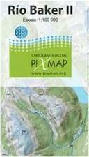
 Image of the Rio Baker #1 map
 Image of the Rio Baker #2 map
 Image of the Rio Baker #3 map
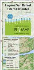
 Image of the Laguna San Rafael map
 Sample detail of the Botswana Touring Map
 Waterproof!
 Sample detail of the Botswana Touring Map
 Sample detail of the Botswana Touring Map
 Sample detail of the Botswana Touring Map
 Sample detail of the Mozambique Touring Map
 Sample detail of the Namibia Touring Map
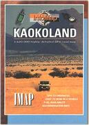
 Sample detail of the Kaokoland Touring Map
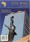
 Image of the Windhoek City Map
 Image of the Swakopmund and Walvis Bay City Maps
 Sample detail from the Owerri city map
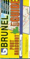
 Sample detail from the Port Harcourt city map

 Sample detail of the Cape West Coast and Cederberg Touring Map
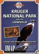
 Sample detail of the Kruger National Park Touring Map
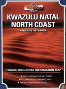
 Sample detail of the KwaZulu Natal Touring Map
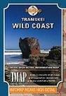
 Sample detail of the Transkei Touring Map
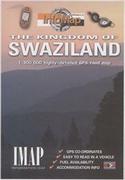
 Sample detail of the Swaziland Touring Map
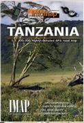
 Sample detail of the Tanzania Touring Map
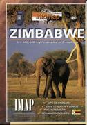
 Sample detail of the Zimbabwe Touring Map
 Sample of the map detail